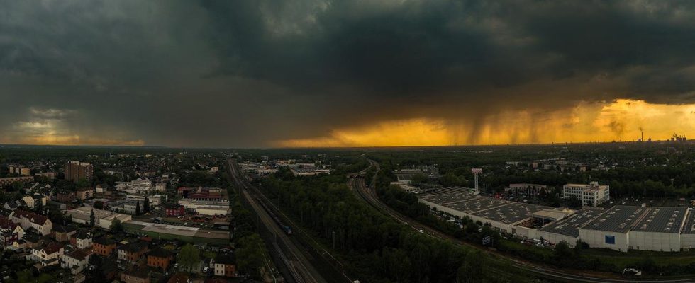
Water in cellars and on streets, lightning strikes, train cancellations: a strong storm has hit western Germany. The German Weather Service is also expecting hail showers and squalls in some parts of the country on Friday.
Thunderstorms and heavy rain have left their mark in some regions in western Germany. In parts of Baden-Württemberg, streets were flooded and streams swelled. Bisingen, southwest of Tübingen, was particularly hard hit, where, according to police, cellars and streets were under water in the early evening. The German Red Cross (DRK) reported around 60 missions in the region. A police helicopter was also used. However, the police were unable to confirm reports of missing people.
According to the police, a street in Schriesheim, east of Mannheim, was under water and there were traffic delays. According to the police, a slope in nearby Heiligkreuzsteinach was in danger of slipping. In the state capital Stuttgart, lightning strikes led to several fire brigade operations. Some roads were closed.
A lightning strike in the Sigmaringen area caused a broken signal box on the railway. According to Deutsche Bahn, no train journeys were possible in the region in the early evening. There were delays and partial cancellations.
Heavy rainfall in the Frankfurt area
The storm also had consequences in other federal states: In Hesse, for example, heavy showers – accompanied by lightning and thunder – fell. In Frankfurt, according to the fire department, the heavy rain caused water to seep in from the sewage system at the Bethanien Hospital and also reach the intensive care area of the clinic.
“We were able to contain the damage relatively quickly and prevent it from spreading,” said the fire department. Patient care is not at risk. The fire department sucked out the water early in the evening using special equipment. No planes were routinely loaded or unloaded at Frankfurt Airport during the storm. This serves to protect the staff, explained a spokesman for the airport operator Fraport. Many evening departures and arrivals were delayed.
In Rhineland-Palatinate, the Eifel region was particularly affected in the early evening. According to the Trier police, there were initial reports of flooded streets after heavy rain and hailstorms. The Koblenz police headquarters reported isolated fallen trees.
A cyclist struggles through a hailstorm in Cologne.
No major damage in North Rhine-Westphalia
The first severe thunderstorms had already passed over North Rhine-Westphalia in the afternoon. The German Weather Service (DWD) recorded focal points in the North Rhine-Westphalian part of the Eifel, in the Bergisches Land as well as in Cologne and Düsseldorf.
In the Euskirchen district the rule was loud WDR Due to the heavy rain, the highest warning level was issued until 4:30 p.m. In the municipality of Dahlem in the Eifel, 36 liters per square meter were measured within one hour. In the High Fens, well over 30 liters per hour per square meter were also measured. In Wuppertal the value was 26 liters per hour.
Across North Rhine-Westphalia there were isolated cases of flooded cellars or underpasses. The fire brigade had to go out on a dozen missions, as in the Euskirchen district. According to a spokesman, these were rather harmless. The Cologne fire department reported that the first of two expected thunderstorms had now passed and that there was no particular number of operations.
The rains also flooded streets in Düsseldorf.
Thunderstorms form at low pressure troughs
The DWD had warned of possible thunderstorms with heavy rain in a strip from southwest Germany to the middle of the country. Local hailstorms and squalls are also possible until Friday night. The greatest danger comes from heavy rain, which can sometimes last for several hours. Precipitation of up to 50 liters per square meter is possible within a few hours.
The DWD cited the cause as a line that stretches from North Rhine-Westphalia to Bavaria and only slowly moves northeast, separating moist and cool air in the southwest from significantly warmer air in the rest of Germany. Thunderstorms form along this low-pressure channel – where exactly cannot be determined in advance.
DWD: Storms will ease on Friday
According to meteorologists, the thunderstorms will subside over the course of Friday, and in the west there could be rainfall of up to 35 liters per square meter within six hours until the morning. For the rest of Friday, the DWD forecast thunderstorms with heavy rain, but probably slightly lower amounts of precipitation, as well as stormy gusts and hail from Lausitz via eastern Brandenburg and Mecklenburg-Western Pomerania to Schleswig-Holstein.

