As of: December 23, 2023 9:40 a.m
After storm “Zoltan” led to many operations for fire departments and police on Friday, the weather situation in the north has now largely calmed down. What remains is heavy rain – even on Christmas Eve. Rail traffic continues to be affected. There is still a severe weather warning in the Harz Mountains.
According to the German Weather Service (DWD), long-lasting rain will also determine the weather during the Christmas holidays. There is widespread rain today in Lower Saxony in particular, from eastern Schleswig-Holstein to Western Pomerania it will be cloudy, sometimes clear and dry for a longer period of time, with isolated snow and rain. In addition, brisk northwest to westerly winds will cause sometimes stormy gusts. The temperatures remain well above the frost line at between 3 and 9 degrees.
Weather on Christmas Eve: slush in the northeast, squalls
Anyone who is still hoping for a White Christmas will probably have to travel far away at very short notice. At most, there will be significant snowfall on the Baltic Sea and in Western Pomerania next night and early Sunday morning, although this is more likely to be noticeable as slush. Be careful of slippery roads! Changeable showery weather continues to dominate. As the day progresses, the wind will increase again from the west to southwest. Then there are strong to stormy gusts, isolated squalls, strong to stormy winds on the North Sea, with heavy squalls towards the evening. The meteorologists are predicting single-digit temperatures, with the coldest temperatures being 0 degrees on Sunday night in the south of Western Pomerania.
Severe weather warning for southern Lower Saxony
One still applies to the Lower Saxony districts of Göttingen, Goslar and Northeim storm warning due to heavy, continuous rain with rainfall amounts between 70 and 100 liters per square meter. According to the DWD, up to 120 liters per square meter can be achieved in storage areas. The Hamburg environmental authority said that caution should still be exercised when entering forests and parks in the coming days. Branches and trees could continue to fall. It was pointed out that entering areas with trees is generally at your own risk.
Further information
Rail: High capacity utilization, train connection canceled
Deutsche Bahn (DB) says it has largely repaired the storm damage. “Regional traffic is running as scheduled again and long-distance traffic is returning to normal,” said a railway spokesman this morning. The railway canceled the train connection for tickets valid up to and including today. Passengers could use their tickets on a later day and cancel seat reservations free of charge, it says on the DB homepage. However, the company also pointed out that long-distance trains were already very busy due to the Christmas period. DB advises that travelers should always check their connection before starting their journey.
Heavy storm surge on the North Sea and in Hamburg
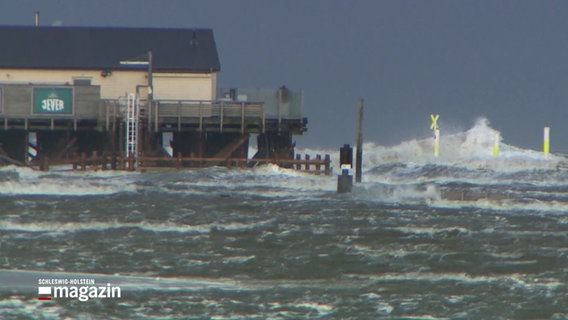
A severe storm surge hit Hamburg and the North Sea coast on Friday morning. A water level of 2.51 meters above mean high water was measured at the Eider barrage near Tönning around 9 a.m., said a spokeswoman for the Federal Maritime and Hydrographic Agency (BSH). This means that the mark of a severe storm surge has almost been reached, which is 2.50 meters above the mean flood.
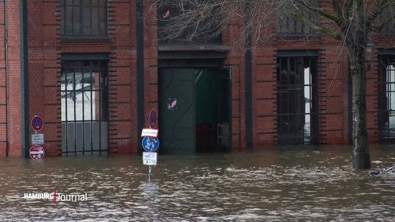
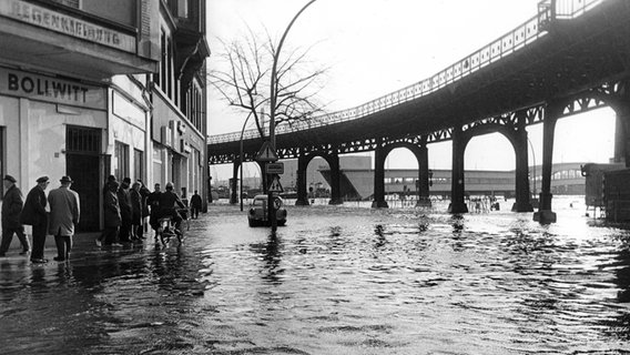
In Hamburg, the flood peak was reached at the St. Pauli gauge at a height of 3.33 meters above mean flood. The fish market and surrounding streets were partially flooded to waist height. Numerous streets in the Hafencity were also under water. A few hours after reaching the summit, the Hamburg police gave the all-clear. “The situation is increasingly easing,” said a spokesman for the interior authority on Friday afternoon.
Further information
We pushed the ferry onto the quay wall
The Norwegian cruise ship MS “Maud” was caught in a severe storm in the North Sea on Friday and was towed to Bremerhaven after a flood and a power outage on the bridge. The Hurtigruten Group said the ship was hit by a “monster wave” with 266 passengers and 131 crew members on board. The Danish authorities said that windows on the bridge were smashed.
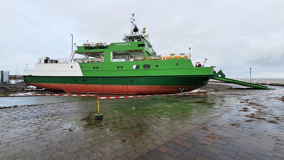
How the “Spiekerook IV” gets back into the water is currently being examined.
A ferry was pushed onto a quay wall at the Neuharlingersiel ferry terminal in the Wittmund district. The managing director of the Neuharlingersiel Port Association said the ship was probably pushed ashore by the storm during flooding. The ship is normally used in island traffic to Spiekeroog.
Bunker part tips over onto the beach on Borkum
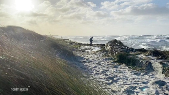
The storm removed large parts of the beaches on Langeoog and Wangerooge. On the East Frisian island of Borkum, a massive bunker element from the Second World War tipped onto the beach. The storm waves would probably have washed it out, said Borkum’s mayor Jürgen Akkermann (independent) NDR Lower Saxony. The concrete part was exposed during the storm surge at the beginning of 2022 and has been hanging clearly visible in a protective dune ever since. According to general assessments, the concrete block poses no danger.
Further information
Several ferries are canceled
Due to the stormy weather, travelers must continue to be prepared for limited ferry traffic in the north. In In Mecklenburg-Western Pomerania, the Weiße Flotte shipping company canceled its ferry trips for Friday. The Wittow ferry in the north of Rügen also stopped operating. The shipping company Scandlines has resumed its regular schedule.
Ferry traffic to and from the East Frisian island of Wangerooge is expected to be largely normal again today after it had to be completely stopped on Friday. Anyone who wants to go to Baltrum or Langeoog must also expect cancellations and delays. Ferry traffic to the other East Frisian Islands has largely returned to normal. The Hallig line between Schlüttsiel and the Halligen, on the other hand, continues to have traffic suspended. Travelers to Sylt also still have to be prepared for restrictions.
Further information
Keywords for this article
Storm


