We are currently dealing with a westerly weather situation. With a westerly current, low-pressure areas are being steered from the Atlantic to Central Europe in rapid succession.
Another low pressure area will reach us on Thursday. The core of the depression is moving across the North and Baltic Seas, while its fronts cross Germany from west to east. Accompanying the low, a storm field hit the southwest of the Republic on Thursday morning and covered the entire south and center over the course of the day.
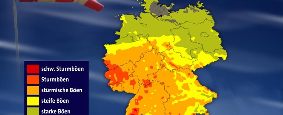
Stiff or stormy gusts are expected here, as our illustration shows. This corresponds to wind force 7 to 8 and wind speeds of around 75 km/h (kilometers per hour). In the mountains, gusts of wind must be expected at the same time, i.e. wind force 9 and top speeds of up to almost 90 km/h (higher mountains even higher).
With the low, rain comes from the Benelux countries and France, which turns into showers and isolated thunderstorms from around midday from the west and southwest to the center of the country. In the area around these showers and thunderstorms, the storm field can be particularly noticeable. Individual heavy gusts of wind (wind force 10 and speeds of around 100 km/h) cannot be ruled out at certain points.
Wednesday, April 3, 2024 (publication date)