A drop of cold air continues to make the weather unstable, especially in the center and south of the country. We look at the development on Thursday.
The cold air drop, i.e. a low associated with cold air in higher layers of the atmosphere, lies over southern Germany on Thursday. The sun heats up the ground during the day, which in turn heats up the lower layers of the air. The air at higher altitudes, meanwhile, remains relatively cold. The temperature difference between the lower and upper air layers increases. At the same time we are dealing with higher humidity on Thursday. So the air is quite muggy. On top of that, there is only a weak wind current. All this together speaks for partly strong and more or less stationary thunderstorms.
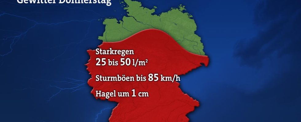
Our figure shows the area where local thunderstorms can be expected on Thursday. And also striking, which side effects can be associated with it. Due to the low current and the relatively high humidity, there is a risk of heavy downpours, up to 50 liters per square meter within a short time. Storm gusts of up to 85 kilometers per hour and hail of around 1 cm in diameter can also occur. The thunderstorms will not hit everyone by far. While there will be thunderstorms in some places, a few kilometers away it will remain completely dry, which is typical for such weather conditions.