
Storm depth Zoltan has reached Germany. Train travelers in particular are feeling the effects. According to a statement from the company, rail traffic will be closed on December 22nd. affected nationwide. There are delays and train cancellations in long-distance transport. The railway lines in northern Germany are particularly affected. The railway informs here about which routes are affected.
During the night, trains were available in Hamburg, Hanover, Frankfurt, Kassel-Wilhelmshöhe, Berlin and Fulda in which stranded train passengers could spend the night. All travelers who arrive on December 21st and trip planned for December 22, 2023 due to the storm Zoltan According to the railway, you can use your ticket at a later date. The train connection has been lifted. The ticket is valid for the journey to the original destination, even with a changed route. Seat reservations can be canceled free of charge.
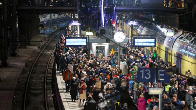
Numerous travelers are waiting for their train on a full platform at Hamburg Central Station on Thursday.
(Photo: Bodo Marks/dpa)
Deutsche Bahn recommends that travelers inform themselves about the occupancy of long-distance trains before they start their journey and, if possible, use connections that are less busy.
Warning of severe storm surges in Hamburg and on the North Sea coast
People on the Elbe, Weser and Ems have to prepare for severe storm surges. In the Elbe area of Hamburg, the police warned of a severe storm surge in the morning. The water levels will then according to the Federal Maritime and Hydrographic Agency (BSH) rise to about 3 meters above mean high water. According to police, the affected area should be avoided. According to the information, the flood peak is expected at around 11 a.m. at the St. Pauli gauge with a height of up to 3.05 meters above the mean flood level.
The experts from the BSH also predicted severe storm surges on Friday for the East Frisian coast and the Weser area. Flood waters there are expected to be 2.5 meters to 3 meters above average in the morning and midday. On the North Frisian coast, water levels of 2 meters to 2.5 meters above mean high water are expected. A storm surge is considered severe if the water level is 2.5 meters above mean high water.

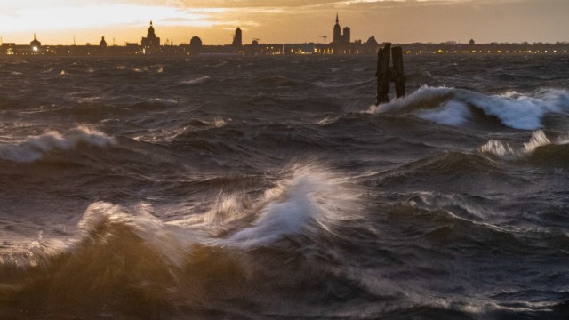
Waves break on the beach on the island of Rügen.
(Photo: Stefan Sauer/dpa)
The storm surge is triggered by strong wind from a constant direction, which builds up the water on the North Sea coast. “When the tidal wave passes the North Sea islands, it runs up the rivers afterwards,” said Jennifer Brauch from the authority’s forecast services for the North and Baltic Seas.
Many ferries were canceled on Thursday, while others had a special timetable on Friday. Ferry traffic between Rostock and Gedser in Denmark was also suspended. In the evening, the more than 900 meter long Fehmarnsund Bridge between the mainland and the island of Fehmarn was completely closed, the police announced.
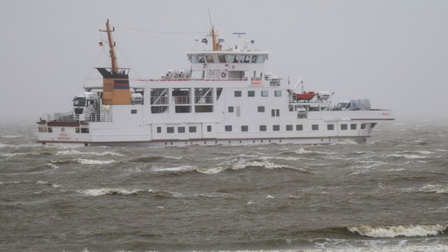
Ferries to and from Norderney have been canceled since Thursday afternoon.
(Photo: Volker Bartels/dpa)
The German Weather Service is expecting gusts of 90 to 110 kilometers per hour on the North and Baltic Sea coasts on Friday morning, and even stronger hurricane gusts are therefore possible. The rest of the country is also experiencing a storm Zoltan continue to create. Although the wind will initially weaken there on Friday, it will pick up again in the second half of the day.
For Bavaria, the meteorologists predicted a lot of snow for the higher altitudes of the Bavarian Forest. The DWD expects stormy gusts or squalls in the Bavarian plains until Saturday, particularly in the foothills of the Alps and generally in the mountains, severe squalls. At higher altitudes in the Alps and the Bavarian Forest there could also be hurricane-like gusts and, in some cases, hurricane-force gusts on the highest peaks. It is expected to rain a lot in the low mountain ranges and the Alps until the night of Christmas Eve. In the Allgäu, the DWD warns of severe, continuous rain.