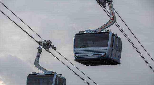
Is the gondola project, supposed to connect the cities of Francheville and Lyon by air, feasible? While the public consultation continues until February 15, we have gone through the feasibility studies, carried out by the Cables Snow Development, S’pace and Sete offices at the request of Sytral. A 164-page file in which the experts analyze and scrutinize the three routes deemed the most relevant. And this, down to the smallest detail. This allows you to get a more precise idea of the file and to compare each of the options considered.
The Francheville-Parc Brûlet-Lyon/Perrache line
The route, which includes 7 stations, would start from Chatelard in Francheville to go to the Perrache district in Lyon, passing through the Parc du Brûlet. A 6.2 kilometer course completed in 26 minutes. Taking into account the socio-economic projections provided by the Urban Agency of Lyon and the public transport projects which must be completed in 2030, this line would make it possible to make 19,000 trips per day, including 16,000 new on the TCL network.
The advantage? A service to “many centralities and hubs generating travel”, in particular thanks to the Perrache station which allows connection to the TER, T1 and T2 trams and to the metro line A. On the other hand, the services of the other stations are considered “perfectible”. “The connections, mainly with the bus mode, can be improved by shifting or bringing closer the stops of the cable car stations”, recommend the experts.
Despite an “excellent network in the west of Lyon”, the project has significant drawbacks, including “a significant impact on the environment”. 22,200 square meters of classified wooded areas risk being sacrificed to set up the stations and part of the 57 pylons. The experts also point to “negative and direct effects” on the historic center of Lyon and on the “heritage quality of the surroundings of historic monuments” such as the Château de Perrache, the ruins of the Château in Francheville or the Sainte-Irénée seminary. Not to mention a “direct impact on the architectural heritage” of the Gier aqueduct. And that’s not all.
The route would also impact “many municipal or inter-municipal plots in the municipality of Sainte-Foy”, add the design offices, highlighting “the sensitive overflight” of the Brûlet park and “many private properties” in the Gravière sector. – Burn.
Finally, last difficulty and not the least: the “risk of instability” of the land is “generally quite marked in the municipalities of Sainte-Foy-lès-Lyon and Francheville”. This could cause landslides or landslides. Some stations and pylons will be located “on steeply sloping land for which access and retaining problems may be encountered”, note the experts.
The Francheville-Lyon/Jean Jaurès line
This 7.2 kilometer link would include 7 stations and would have a similar route on the first part of the route. The difference ? It would then branch off via the Confluence district in Lyon and end in the Jean-Jaurès sector in the heart of the 7th arrondissement. This would avoid the establishment of a station in Brûlet park. Despite this, nearly 18,000 square meters of classified wooded areas are threatened with clearing.
The estimated journey time is 29 minutes for a transport capacity of 16,000 trips per day. In terms of intermodality, the design offices emphasize “a perfect connection” thanks to the services of Confluence stations, where travelers can fall back on the T1 and T2 trams, and Jean-Jaurès, where line B of the Metro. However, the route is “the most consumer”. In other words, it is the one that impacts the most cadastral plots: 313 including 97 condominiums or private properties. Among which, 81 will see the cabins pass above their heads, at 10 meters in height, 50 meters or sometimes more.
This link is also the one that would expose the most people to possible noise pollution: 4,400 inhabitants “in the 200-meter band” around the various stations, observe the design offices.
The Francheville-La Mulatière-Lyon/Gerland line
Despite “perfect” intermodality with the Gerland metro station, this third scenario is considered by the design offices as “relatively unattractive” in terms of travel since it would make it possible to make 9,000 trips per day. That is much less than the two previous links. The impact on the environment “would be greater” than that of other lines studied. 29,500 square meters of classified wooded areas would be threatened. The completion of this link would also have “negative effects” on “the perimeter of protection” and “the heritage quality” of the surroundings of the Stade de Gerland and the Halle Tony Garnier, classified as historical monuments.
Here again, the “potential risks” of landslides or rockslides are underlined by the experts. This is the case, for example, of the Le Pras and Le Roule – Grand Cèdre resorts, which must be located in “steeply sloping areas”. “Overall, the risk of instability is quite marked on the Mulatière”, point out the design offices. Finally, even if the project is the one that would impact the fewest plots (188), it would fly over “many private properties” in the Balme district at Mulatière.