Things were bubbling underground for weeks. There have been thousands of earthquakes in the region in recent weeks. Another series on Monday evening was followed by the long-feared outbreak!
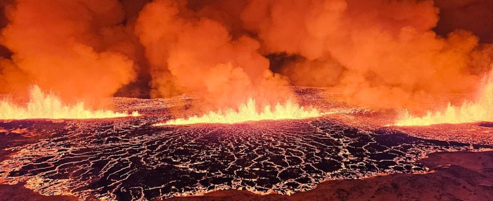
Starting at 10:17 p.m., the Reykjanes volcano in southwest Iceland spewed lava and debris into the air, according to the Icelandic Meteorological Office. Smoke rose for miles across the night sky, turning it bright orange. Video shows lava gushing out of a kilometer-wide crack.
The crack in the earth’s surface is about 3.5 kilometers long and is expanding rapidly, the weather office said.
About 100 to 200 cubic meters of lava flowed per second, many times more than in previous eruptions in the region, Icelandic seismologist Kristin Jonsdottir told public broadcaster RUV. “It happened really quickly.”
The eruption bathed the night sky in a blinding orange light
Geophysicist Benedikt Ofeigsson from the Icelandic Meteorological Agency said the eruption was located at Sundhnjúka crater, about three kilometers from the town of Grindavík, according to local media reports. At the moment it is difficult to say whether infrastructure or the town of Grindavík is in danger.
Prime Minister Katrin Jakobsdottir said her thoughts were with the people of the area. “We hope for the best, but it is clear that this is a significant outbreak.”
Iceland’s President Gudni Jóhannesson wrote on Facebook that it was still unclear what damage the eruption could cause. He asked local people to follow all recommendations from emergency services “at this dangerous moment”.
Week-long series of earthquakes
In November, police evacuated the town of Grindavik after strong seismic activity in the area damaged homes and raised fears of an impending eruption. There have been thousands of earthquakes in the region in the past two months.
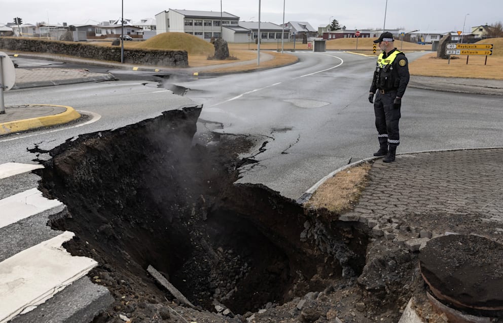
Roads opened up during earthquakes in recent weeks
Grindavik, a fishing village with 3,400 inhabitants, is located on the Reykjanes Peninsula, about 50 kilometers southwest of the capital Reykjavik and not far from Keflavik Airport, Iceland’s main airport for international flights. The Blue Lagoon tourist attraction, located just a few kilometers from town, was only reopened at the weekend after a temporary closure. It is only around 40 kilometers southwest of the capital Reykjavík. According to reports, there were no guests there at the time of the eruption.
The red warning level was temporarily declared for aviation, but this was then downgraded back to orange. The airport operator Isavia said on its website that there are currently no disruptions to take-offs and landings at Keflavik International Capital Airport.
The current volcanic eruption is the fourth in Iceland in two years. With more than 30 active volcanic systems, Iceland is the largest and most active volcanic region in Europe. Iceland lies between the Eurasian and North American plates. Because the plates move in opposite directions, earthquakes and volcanic eruptions occur again and again in the island nation. In 2010, the eruption of the Eyjafjallajokull volcano forced hundreds of Icelanders from their homes. Around 10,000 flights had to be canceled.