Google developed the “Dynamic World” web application together with the World Resources Institute and is intended to be used by scientists, governments and companies alike. But the images can also be interesting and frightening at the same time for private individuals. The company says about the tool: “This level of detail enables scientists and policymakers to see and quantify the magnitude of recent events – such as snowstorms, wildfires or volcanic eruptions – anywhere in the world within a few days,” says Dynamic World. The before-and-after plots, for example, clearly show the magnitude of the century flood in the Ahr Valley in July 2021. Such recordings are made possible by the technology of the Copernicus Sentinel 2 satellites, which take around 5000 new pictures every day and save them in the Dynamic World database.The older recordings date back to 2015, the current pictures are according to the company depending on Stan there not older than 2-5 days.
Google tool Dynamic World uses satellite data to make the Ahr valley flood visible
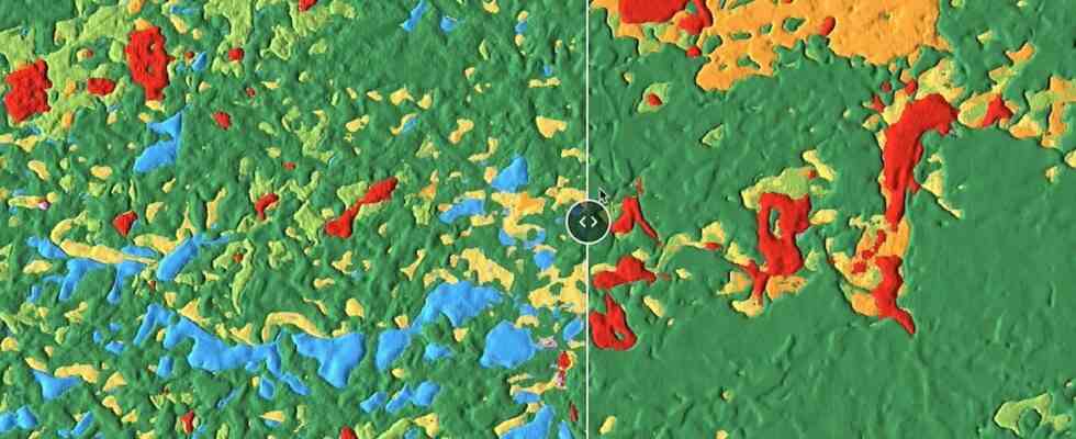
Watch the video: New Google tool uses satellite data to make the extent of the Ahr valley flood visible.