
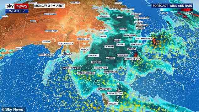
Residents in four states have been warned to brace for flash flooding as a massive rain bomb smashes the east coast of Australia.
NSW, Victoria, Queensland and Tasmania will be battered by heavy downpours and thunderstorms as a slow moving low pressure system continues to wreak havoc.
Sky News Weather meteorologist Alison Osborne has warned the wild weather could become worse with the possibility of an east coast low forming over the weekend.
‘So this is a serious forecast. And people are urged to remain alert,’ she said.
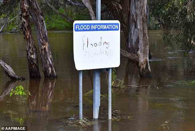
The Bureau of Meteorology has already issued a spate of flood warnings across the country with 88 issued in NSW alone as of Friday night.
More than 100 callouts have been made to the SES, a driver has been saved after their car was cut off by rising floodwaters, and hundreds of millimetres of rain has been dumped overnight.
Residents have been told to prepare for the worst with the heavy downpours expected to last through the weekend.

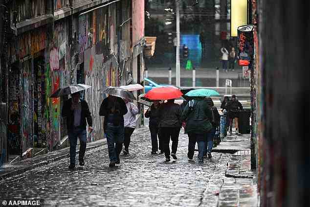
Residents have been told to prepare for the worst with the heavy downpours expected to last through the weekend (pictured, Sydneysider in the rain)
Residents in four states have been warned to brace for flash flooding as a monstrous rain bomb smashes the east coast of Australia
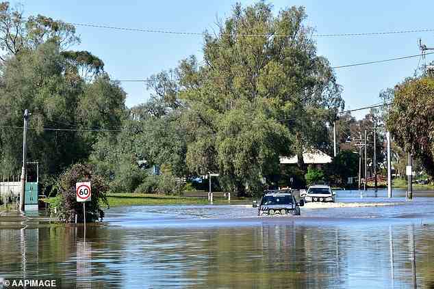
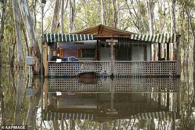
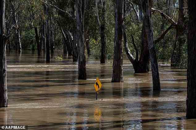
Sky News Weather meteorologist Alison Osborne has warned the wild weather could become worse with the possibility of an East Coast Low forming over the weekend (pictured, flooding in Echuca, Victoria, on Monday)
NSW, Victoria, Queensland and Tasmania will be battered by heavy downpours and thunderstorms as a slow moving low pressure system continues to wreak havoc
NSW
Eighty-eight flood warnings were current for NSW on Friday night, with the focus of the crisis in the state’s far northeast and southeast, close to the Victorian border.
In the north, emergency warnings were in place for Narrabri and the hamlet of Terry Hie Hie, while in the southern borderlands an emergency alert was in place for Moama, where hundreds of people have been ordered to evacuate.
The Bureau said a developing area of focus for the next 48 hours would be the state’s northeast as a trough and possible low-pressure system developed off the coast, bringing heavy rain to the Northern Rivers, including Lismore and Byron Bay.
‘Exact rainfall amounts will depend on where this trough forms and how it moves and in particular whether the low-pressure system develops near the coast, or further offshore,’ the Bureau said.
‘Heavy rain may bring both a flash flooding and riverine flooding risk.’
A flood watch has been issued for the Lower Hunter, Hawkesbury-Nepean and the Colo Rivers.
Byron Bay is expected to receive between 60 to 80mm and Coffs Harbour up to 50mm on Sunday.
The Bureau forecast rain and storms on Saturday for eastern NSW, including Sydney, where it predicted a thunderstorm would bring heavy falls, causing flash flooding.
In Sydney, residents in the city’s west were expected to bear the brunt of the weather.
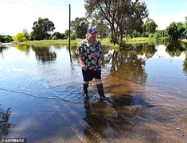
Resident in Forbes, NSW, after heavy rain led to flash flooding in the city on Monday
Victoria SES chief operations officer Tim Wiebusch warned river levels were rising at a rapid pace (pictured, Melbourne residents)
Victoria
The Bureau has warned of widespread flooding across the state with evacuation orders issued for Echuca and renewed fears flooded Shepparton could be hit again.
Victoria SES chief operations officer Tim Wiebusch warned river levels were rising at a rapid pace.
‘We’re currently seeing water levels around that 94.75m [mark] on the Murray River through to Echuca this morning,’ he said.
‘We are expecting the peak to occur from Sunday night into Monday, around that 95m mark.
‘We’re also keeping a very close eye on the Kerang community. Water levels are at 77.92 as it heads towards a peak of 78m.’
Residents in the northern Victorian town of Kerang are being told it’s too late to leave but the community is standing strong in the face of rising floodwaters.
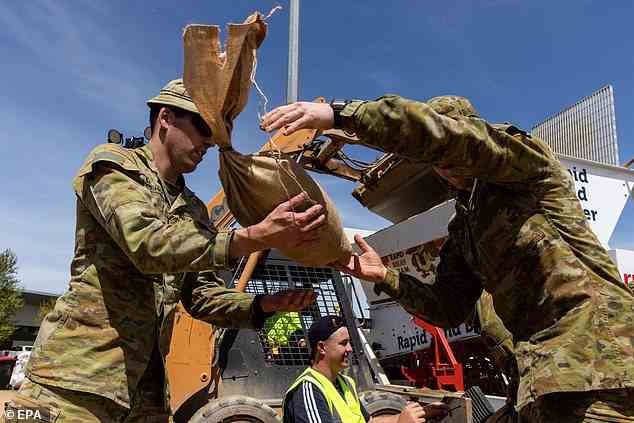
ADF personnel help to hand out sandbags in Shepparton on Monday as floods battered the region
Regional Victoria has been hit by widespread flooding with the worst felt in Shepparton
Heavy downpours over the past week has led to flooding across NSW including Forbes
A bridge connecting the town to the Murray Valley Highway has been closed since Wednesday night, prompting warnings from the State Emergency Service that people could no longer evacuate.
But Gannawarra Shire Mayor Charlie Gillingham said residents could still leave for Swan Hill or other northern towns via three separate routes.
Those major roads will slowly close over the next week as floodwaters rise but Mr Gillingham said many locals were still choosing to stay.
‘I suppose about 500 have left but there’s still probably 3,000 in town,’ he said.
‘There’s certainly plenty of people walking up and down the street.’
The SES has already received 100 callouts for help from residents in Geelong.
hree people were rescued after driving through floodwaters and more than 85 millimetres of rain was recorded in nearby She Oaks.
‘We can’t emphasise enough – do not drive through flash floodwaters. It could be the last decision you make,’ Mr Wiebusch said.
The SES has received more than 8,300 calls for help since the weather emergency began and more than 750 flood-related rescue requests.

Byron Bay is expected to receive between 60 to 80mm and Coffs Harbour up to 50mm on Sunday (pictured, Sydneysider braving the rain)
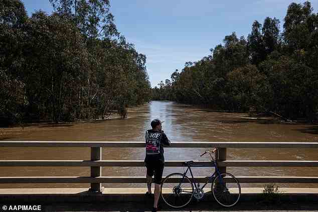
The flooded Lachlan River in NSW as downpours continue to smash the east coast of Australia
Queensland
Heavy downpours have been smashing regional Queensland with more than 100mm of rain recorded in some parts of the state overnight.
Some 243mm fell at Coops Corner on the Noosa River and 211mm in Tin Can Bay.
A driver was winched to safety after their car was swept off the causeway near the Bauple Drive-Bruce Highway exit on Friday.
The Bureau warned the wild weather will barrel towards the south east of the state over the coming days.
‘The system is expected to drift gradually to the south, and it may affect South-East Queensland later on Saturday or during Sunday, though there is still a large amount of uncertainty in the forecast position and track of this system,’ the Bureau said.
‘Heavy rainfall, which may lead to flash flooding, is forecast for areas east of Seventeen Seventy, Biggenden, Jimna and Maroochydore.’
Hervey Bay is forecast to cop 40 to 70mm of rain on Saturday and another eight to 25mm on Sunday.
Brisbane will likely receive 35mm today before another 60 to 90mm is dumped on the city tomorrow.
Lord Mayor Adrian Schrinner said evacuation and community centres had been prepared and were ready to house residents if they needed to flee their homes.
‘We have also distributed more than 55,000 bags since staging our three super sandbag weekends,’ he said.
‘Our new flood mapping is free and available so residents can learn the risks related to their property.’
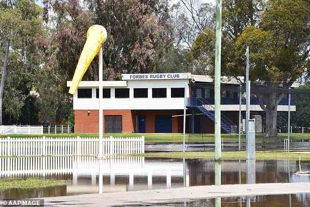
Flooded rugby club at Forbes in NSW after heavy rain battered the state on Monday
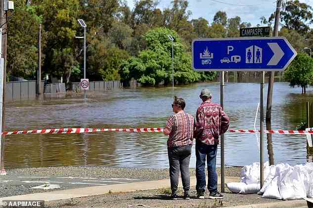
Traffic sign close to Goulburn River at Shepparton, in Victoria, following flooding on Monday
Tasmania
The Bureau has cautioned residents ‘lives could be at risk from flood waters’ with flooding likely across the state between Friday and Saturday.
Watch and act alerts were issued overnight for regions including Liffey, Deloraine, Meander, Red Hills and Mole Creek.
Some 25mm is forecast to fall in Hobart on Saturday as heavy downpours fall elsewhere across the country.
The wild weather is set to ease on Sunday before picking up again on Monday.
Tasmania SES Acting Director Leon Smith revealed plenty of rain was still on its way.
‘The low-pressure system causing this weather is continuing to develop into next week, and at this stage we expect Monday and Tuesday to be the wettest days,’ he said.
He urged residents to take care and keep an ear out for the latest flood updates.
‘With heavy rain, this means knowing your flood risk and understanding whether your street and home are prone to flooding. As always, SES crews are ready to assist if needed,’ he said.
‘Anyone in an area affected by rains is encouraged to be vigilant, never enter or drive through floodwaters, and when driving look out for debris on roads including fallen trees and power lines.’
Victoria SES chief operations officer Tim Wiebusch warned river levels were rising at a rapid pace (pictured, Goulburn River in Victoria)
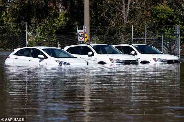
Cars are submerged in floodwaters after heavy rain was dumped over Shepparton, in Victoria, on Monday