Those who travel by train to the starting point of the new long-distance hiking route through Graubünden can already see part of the way from the train window of the famous Bernina Express. In endless hairpin bends, the path and route wind their way down from the 2253-metre-high Bernina Pass into the Valposchiavo in the direction of Italy to Tirano (429 metres). The highest non-cog railway in the Alps is part of the Unesco World Heritage together with the Albula line.
Day 1: Poschiavo – Bernina Pass
Route: 14.6 kilometers, 1254 meters in altitude, 6 hours
The five-day hike begins in Poschiavo at around 1000 meters above sea level, a village with stone-tiled houses and a street with unusual palazzi built by Poschiavo people in the 19th century after they had become rich as confectioners in Italy and Spain .
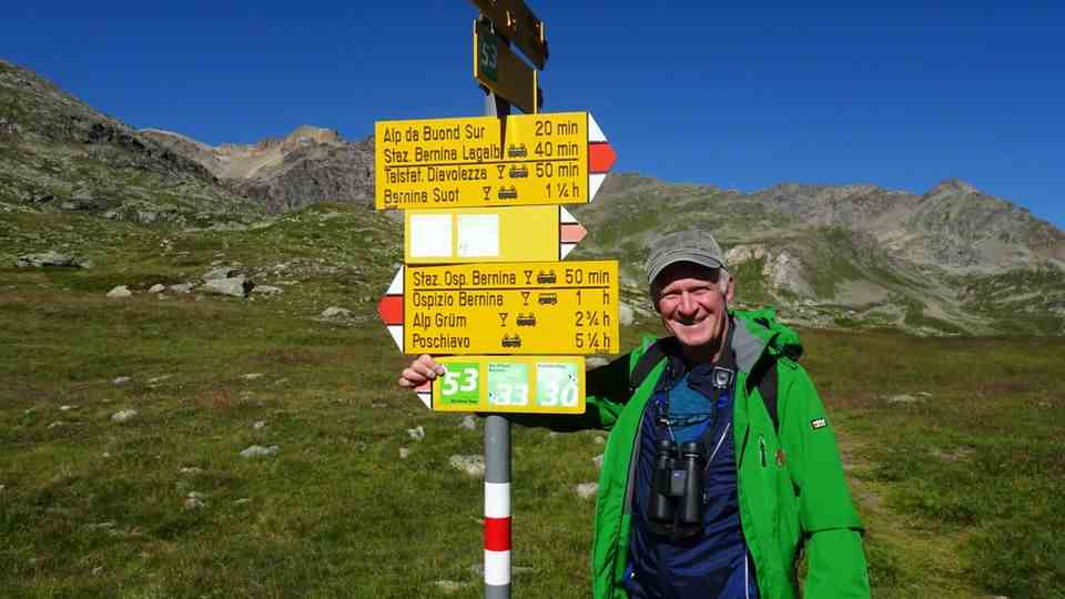
Path 53, well marked on yellow signs, first leads through forests and meadows to the Cavaglia glacier garden and steeper to Alpe Grüm, an isolated railway station and the Ristorante Belvedere. Above the tree line, it then goes almost always parallel to the railway line past Lago Bianco to the Passo del Bernina with its hospice.
If you still have time, you should take a look at the Camera Obscura, which opened three years ago. In the dark room, the eyes see nothing at first. But after ten minutes of getting used to the darkness, the outside world appears like a shadow on the round wall: the Alpine panorama standing upside down – like the image from an analogue webcam.
Day 2: Bernina Pass – Diavolezza
Route: 13 kilometers, 1240 meters in altitude, 5 hours
Down to the Lago Bianco and the Lej Nair, the watershed between the Adriatic and Black Seas and into the lonely Val d’Arlas. Soon the sounds of the motorcycles accelerating on the pass road can no longer be heard, but the whistling of the marmots accompanies you. The green of the alpine pastures has long since given way to scree fields. Soon the Lej da Diavolezza lies beneath you in turquoise blue, and the neighboring cable car transports guests silently and comfortably to the Diavolezza mountain station.
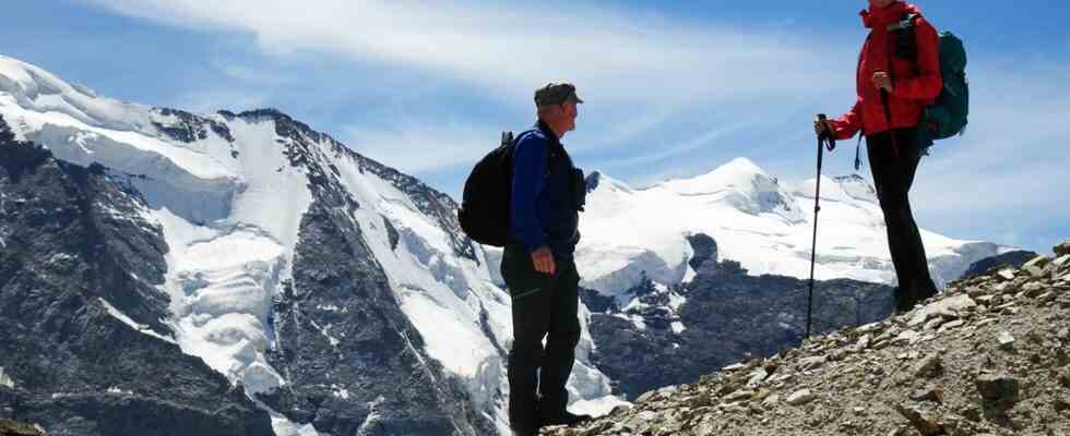
What a grandiose panorama awaits you after five hours of walking: the glacier world of Piz Palü and the Bernina Group. In literature, the view from the Diavolezza, the “she-devil”, is often called the “festival hall of the Alps”. This formulation goes back to a publication by Walther Flaig (1893-1972), an early NSDAP member who, among other things, spied on Jewish escape helpers and was sentenced by a Swiss court to 30 months in prison and an entry ban to Switzerland in 1944.
Day 3: Diavolezza – Pontresina
Route: 14 kilometers, 1125 meters in altitude, 5 hours
Today it’s time to rest your knees first: the cable car takes you down into the valley in fifteen minutes and on the opposite side into the Val da Fain. There the ascent begins at 2700 meters to Fuorcla Pischa, a high valley with several small lakes up to Alp Languard – with a fantastic new view of the Piz Bernina.

In the summer of 2020 he marked the Bernina Tour 53 in two months: Guido Demont. For this he put up 86 panels and placed 235 green stickers.
© Till Bartels
On the way back to Pontresina in the Val Bernina, you can also use the chairlift to descend from the Alm. The mountaineering resort is known for its accommodation, especially for the Grand Hotel Kronenhof, which has been preserved in the Art Nouveau style.
Day 4: Pontresina – Surlej
Route: 14 kilometers, 1070 meters in altitude, 5 hours
Change of course in the direction of the glaciated mountains: from the 1,800-metre-high town, the route takes you leisurely up through the tranquil Val Roseg to the Roseg Glacier excursion restaurant with its tempting cake buffet.
Strengthened, it is now time to gain altitude over the deserted Alp Surovel. But with every meter the view of the Piz Monteratsch, the Piz Bernina with the firn-covered Biancograt and the Piz Roseg becomes more impressive, until the pass at the Fuorcla Surlej is reached. It’s just under an hour downhill to Murtel, the middle station of the Corvatsch cable car, which takes you down to Surlej, the last place to spend the night, in no time at all.
Day 5: Surlej – Maloja
Route: 15 kilometers, 210 meters in altitude, 4 hours
On the last day, you first have to go back to Murtel by cable car and with a view of the completely different landscape of the Upper Engadine. The Silvaplanersee and the Silsersee sparkle silver in the high valley of the Inn.
From now on it’s almost all downhill to the end. The mountain trail leads over the Alp Prasüra to Sils, the place with two famous buildings: the Nietzsche house in the town center, where the philosopher wrote, among other things, “Also spoke Zarathustra” in the summer months of the 1880s, and the Waldhaus Sils, a Family-run hotel in the fifth generation, which towers over the town like a castle.
The long-distance hiking trail 53 ends in the village of Maloja at the pass of the same name. Before the Postbus takes you back to St. Moritz and into a completely different world, you have to cool off your battered feet and blisters in cool spring or lake water.
Further information: www.graubuenden.ch, www.schweizmobil.ch, www.eurotrek.ch
Also read:
– Off through the Greina plateau: A hike from Graubünden to Ticino
– Swiss railway adventure trail Albula: Hiking along the Unesco World Heritage route
– Climate change in the mountains: “Investing in snow cannons is crazy

