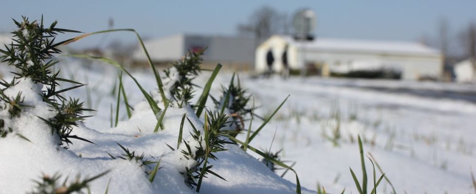
By fleeing the sun this summer and walking around in shorts in October, we had almost forgotten this sensation which makes the hairs on our arms stand up and causes a little cloud when we breathe: the cold. The end of November is approaching, and the leaves are still clinging to the trees, the warmest scarves still stored in the “winter special” suitcase in the attic.
But maybe not for long. Judging by Météo-France forecasts, a severe cold spell is expected to hit France in the coming days, bringing the first frosts of the season. How far will the thermometer go? Can we really talk about a “cold wave”? Is this good news ahead of the Christmas holidays? 20 minutes takes stock with Patrick Galois, forecaster at Météo-France.
What weather can we expect next week?
After the storms from the Atlantic, there is “cold air coming from the north-east, arriving via the Belgian and German borders”, explains Patrick Galois. While the thermometer shows 8 to 12 degrees in most French regions, a “first drop” should occur this weekend, with the first frosts near Bourges, Chaumont or Limoges, before “a false rise on Monday”. The fault is a rainy disturbance which will sweep across the whole of France.
The cold will return on Tuesday, “with a maximum extension on Wednesday and Thursday”. The phenomenon is “difficult to regionalize, we will be below seasonal norms everywhere,” says the forecaster. The “peak of the coldest day” is expected to be Thursday, with temperatures “up to 4 to 5 degrees below normal.” Thus, we must expect “frosts between -5 and 0 degrees at night in three-quarters of the country”, and values between “0 and 4 degrees in the north-east, 10 to 12 in the south ” in the afternoon. But “there is still a margin of error in the six-day forecasts”, tempers Patrick Galois.
Can we really talk about a cold snap?
If the thermometer will drop by nearly ten degrees in a few hours, the “term cold wave is not appropriate” to define this phenomenon, the forecaster decides. First, because Météo France has “very specific criteria, and not at all met here” to speak of a cold wave: temperatures 5°C lower than seasonal norms, with at least three consecutive days having a temperature average of 0.9 degrees across the country, including one at -2°C.
Suffice it to say that, both in terms of intensity and duration, we are not there. The feeling of extreme cold will in fact come from the difference with the temperatures experienced during the year. “The year 2023 was very mild, with cool sequences largely in the minority compared to warm and little marked sequences”, develops Patrick Galois. Several institutes have noted heat records lasting several months, and 2023 should be the hottest year on record, according to the American Oceanic and Atmospheric Observation Agency. “To find an anomaly around -5 degrees, we have to go back to December 2022,” adds the forecaster.
Is this at least good news for the winter holidays?
Not even. However, “the rain-snow limit will drop”, with snowflakes “below 1,000 meters”, assures Patrick Galois. But the end of November is far too far from the holidays to be able to promise to ski while waiting for Santa Claus to come by. “All the mountains will turn white, but that doesn’t guarantee snow at Christmas because there could be mild spells,” explains the forecaster. At least the mittens will already be ready if the white coat persists.