Changeable weather with showers and thunderstorms is an issue this spring. We want to see how such capricious weather develops and which phenomena can be observed.
In meteorology, a distinction is made between stratiform and convective precipitation. The former are widespread and last for a long time. Their intensity is mostly weak to moderate. The situation is different for convective precipitation, showers and thunderstorms. Showers are characterized by their intensity changing very quickly. Just now it’s only raining lightly, then it’s pouring. They are local. Massive amounts of water can fall from the sky in one part of the city while it remains dry in another part of the city. Most of the time, showers last a short time. But this does not always have to be the case, showers can also move over the same area again and again for several hours. Basically, a thunderstorm is nothing more than a shower, only a lightning discharge has to be observed for the meteorologist to register a thunderstorm. What conditions must be met for showers or thunderstorms to develop?
Normally, the atmosphere is stratified rather stable and the air movements are therefore almost exclusively horizontal. The situation is different in showery weather: On such days, the temperature difference between the ground and the higher atmosphere is particularly large. As air rises, it cools by one degree per 100 meters as it pushes into areas of lower pressure. This cooling effect when the pressure decreases can also be observed when the air is released from a bicycle tube. As soon as clouds form in the atmosphere, and the air mass has to be humid enough for this, the cooling rate is lower, since heat is released through condensation. However, in order for the air to be able to rise at all, the surrounding air must always be colder than the air coming from below. The atmosphere must therefore be stratified in such a way that the decrease in temperature with altitude is large. Then one speaks of an unstable stratification and heavy showers can occur. Areas with rising air and rain are close to cloud-free areas, which are caused by the fact that the air has to sink again somewhere. There are several reasons why the air stratification becomes unstable. Incoming maritime polar air is damp and cold, but is often warmed up in the lower air layers. In autumn and winter, this occurs on the way the air masses reach us through the relatively warm North Sea or the Atlantic, in spring and summer due to the strong solar radiation over Germany itself. Showers in polar air occur most frequently in April. However, unstable air stratification can occur in any air mass, not just in polar air, if a low-pressure area determines the weather. In a depression, the air is lifted. It cools down more at higher altitudes than in the lower air layers. But even at the edge of highs, showers and thunderstorms can be triggered in the summer months when the weather is actually nice. The air mass only has to be moist enough for the sun to warm up the air near the ground. These showers and thunderstorms tend to form over the mountains.
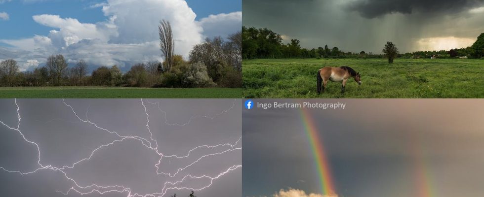
Viewed from afar, showers and thunderstorms can be recognized by white cloud towers. In meteorology, shower clouds are referred to as cumulonimbus. The photo at the top left of the figure shows one. For the layperson, it is often not possible to see from a distance what is in the cloud. It looks different as soon as a shower or thunderstorm approaches. The underside of the clouds then appears menacingly dark and the falling precipitation forms veritable curtains, as in the photo at the top right of the figure. Lightning is an impressive natural spectacle. Sometimes they run from cloud to cloud, sometimes they strike the ground as a lightning bolt. Since it is never clear how lightning will pass, staying outdoors should be avoided as soon as a thunderstorm is brewing. A rainbow can sometimes be observed on the edge of showers and thunderstorms. To do this, the sun must be behind the observer and shine on the curtain of precipitation. The photos were taken in spring 2023 in the Palatinate.