Low pressure areas will take over the weather control over the next few days. We look at the development and the expected amounts of rain.
After a high on Monday ensured calm weather, especially in the north-eastern half of Germany, a first low is already noticeable in the south-western parts of the country in France. A few more lows will follow throughout the week. The influence of high pressure is no longer an issue, which then applies to all of Germany. With a southwest to westerly current, mild air flows continuously from the Atlantic and temporarily also from the Mediterranean. The temperature therefore remains at a relatively high level.
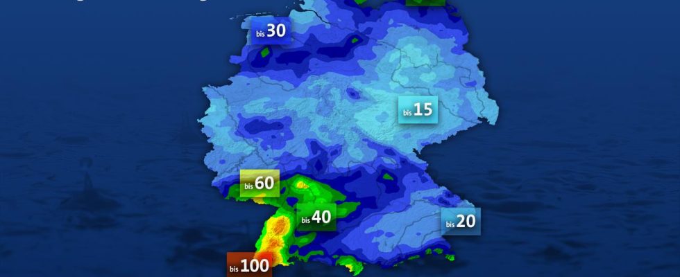
Our figure uses a model forecast to show the amount of rain expected up to and including Friday. This often falls between 20 and 30 l/m² (liters per square meter). The main rainfall is in the southwest of the country, where 40 to 60 l/m² can occur in some areas and up to 100 l/m² in the Black Forest. You can also expect up to 40 l/m² on the Baltic Sea. In the lee of the low mountain ranges, however, only between 5 and a maximum of 15 l/m² arrive in parts of Saxony-Anhalt and Thuringia.
Monday, October 23, 2023 (publication date)