Weather
Severe storm surges expected – rail and ferry traffic disrupted
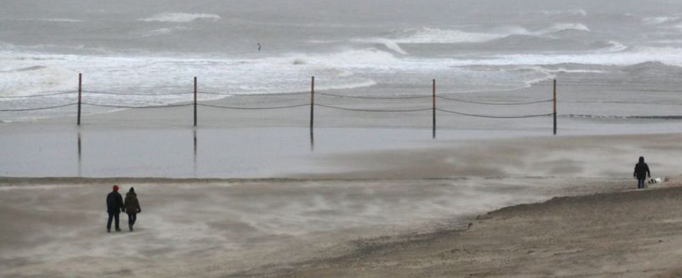
Beach walkers brave the strong wind on the island of Wangerooge. photo
© Peter Kuchenbuch-Hanken/-/dpa
Storm “Zoltan” is rushing across the north with force. Not only is there a lot of wind, but also a lot of water – and a warning of severe storm surges.
Storm “Zoltan” has reached Germany – travelers by train and ship began to feel the first effects on Thursday. In the evening there were many failures at Deutsche Bahn, especially in the north. In Lower Saxony, trees fell and Christmas markets were closed. Fire departments prepared for operations on Friday night. Meanwhile, people on the Elbe, Weser and Ems have to prepare themselves for hardship Adjust storm surges.
The Federal Maritime and Hydrographic Agency predicted a severe storm surge in Hamburg on Friday night. The water of the Elbe could rise 2.5 meters above the mean flood level. There is a risk of storm surges until around 11:25 p.m.
The Federal Office predicted another severe storm surge for Friday morning on the Elbe, Weser and Ems. Water levels are expected to rise to more than 2.5 meters above mean flood between 8am and 12pm.
The storm surge is triggered by the fact that the wind is currently blowing consistently strong from one direction and is causing the water to build up on the North Sea coast. “When the tidal wave passes the North Sea islands, it runs up the rivers afterwards,” said Jennifer Brauch from the authority’s forecast services for the North and Baltic Seas. In view of the expected storm surge, the Hamburg police warned against staying in low-lying areas around the Elbe during this time.
Already on Thursday, many ferries between the Halligen and the mainland were canceled, as the Wyker steamship shipping company announced. A special timetable applies to other ferries on Friday. Ferry traffic between Rostock and Gedser in Denmark was also suspended.
Wind pushes water onto the coast
The effects are greater on the railway, which already has more passengers than usual due to the upcoming holidays. A number of connections in Deutsche Bahn’s long-distance transport were canceled; for example, at times no train ran on the important connection from Berlin to Hanover, as shown on the online information channels the DB could be seen. A dpa reporter reported from a train from Hamburg to Hanover that Hanover station could not be reached due to overcrowding. Regional and long-distance trains were also canceled at Hamburg Central Station.
According to the railway, there were restrictions due to storm damage, for example on the Kiel-Hamburg, Hamburg-Westerland and Kiel-Hamburg-Bremen-NRW routes. The intercity connection Hamburg-Copenhagen is also affected. The railway also reported weather-related delays and cancellations in regional transport on Thursday.
The DB has canceled the train connection for Thursday due to the numerous disruptions. Passengers could use their ticket on a later day. However, the DB also pointed out that long-distance trains were already very busy due to the upcoming Christmas period.
Tree falls near bus stop
Storm “Zoltan” brought many operations for the fire brigade on Thursday. There was initial damage in Bremen and Wilhelmshaven. According to the fire department, a 15-meter-high tree fell next to a bus stop in the Hanseatic city. So no one was injured. In the south of Brandenburg, the emergency services counted around 68 missions from the afternoon until the early evening hours. According to a spokesman in Berlin, a person was injured by a fallen tree in the Hakenfelde district of Spandau.
The storm also made itself felt in other countries. The storm has already caused problems for travelers in Great Britain. Schools on the Shetland Islands remained closed. In some places trees fell or the power went out. There were also temporary restrictions on air and rail traffic. In Denmark, isolated flights from Copenhagen Airport were canceled, as were trains in the western Jutland region.
Meteorologists: Winds are expected to pick up again on Friday afternoon
The German Weather Service is expecting gusts of 90 to 110 kilometers per hour for the North and Baltic Sea coasts on Friday morning, and even stronger hurricane gusts are therefore possible. Storm Zoltan also continues to cause problems for the rest of the country. Although the wind will initially weaken there on Friday, it will pick up again in the second half of the day.
In North Rhine-Westphalia, continuous rain and storms left their mark. A tree crashed onto a regional train in Willebadessen near Paderborn. According to the police, the train with its 200 passengers could not continue and had to be evacuated to the open route. In Bielefeld, 60 emergency services from the fire department and technical relief organization went to a horse farm because of the constant rain.
The weather also has an impact on many Christmas markets, which will soon close their doors anyway. As a precautionary measure, several Christmas markets in North Rhine-Westphalia remained closed on Thursday, for example in Essen and Duisburg. Düsseldorf closed in the afternoon. On Tegernsee, two Christmas markets in Rottach-Egern and Bad Wiessee (both in the Miesbach district) cannot open on Friday due to high wind speeds; in many cities, parks and cemeteries will remain closed until Saturday.