Weather in Germany
Deep “Andreas” ensures the first snow – the map shows where winter is falling everywhere
Chilling on the Erbeskopf, the highest mountain in Rhineland-Palatinate: There was already plenty of snow here on Saturday night.
© Harald Tittel / DPA
White above and green below – this is how the German Weather Service (DWD) sums up the weather in the coming days. Deep “Andreas” makes himself comfortable over Central Europe. On Saturday there was already a heavy load of snow in some places.
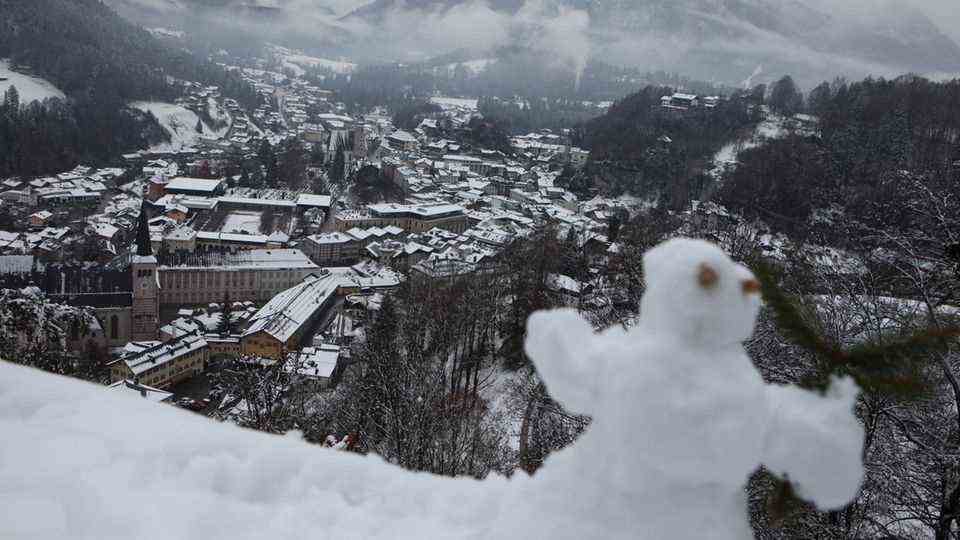
Deep “Andreas” ensures the first onset of winter in Germany even before the official start of winter. Whether in Berchtesgaden, on the Erbeskopf in Rhineland-Palatinate or in the Sauerland: In many places, the first weekend in Advent looked a bit like a winter wonderland.
As the German Weather Service announced on Saturday, “Andreas” shovels moist and cold air of polar origin into our climes. Since the North Sea is still quite warm, however, it is usually only enough for cold, wet, dreary weather in the flatlands. In contrast, it is completely different in the higher elevations of the low mountain ranges and the Alps. Winter has arrived there. However, the quantities are usually still quite manageable.
Deep “Andreas” ensures the first snow
Last night, especially in the Hunsrück, Rothaargebirge and Black Forest above around 500 to 600 meters, more than ten centimeters of fresh snow fell from the sky. The Kniebis mountain ridge in the northern Black Forest got a large load of fresh snow last night. There they measured 25 centimeters. However, this is nothing unusual for the region there, because the Kniebis is a real snow hole in winter and a popular excursion destination. In other parts of Germany, as in some low mountain range regions or in parts of Bavaria, there was hardly more than one to three centimeters.
On Saturday, too, low “Andreas” provided snow in some parts. Four centimeters of snow fell on the almost 1215 meter high Fichtelberg. The highest point in Saxony had already been “covered in sugar” for days, but it was the first snow that remained, at minus five degrees Celsius, according to a meteorologist from the German Meteorological Service. Skiing started with two lifts initially in Winterberg in the Sauerland. The first ski fans took advantage of the offer in the morning. For the first weekend in Advent, two slopes had been prepared, as a spokeswoman for the ski area reported.
DWD: If you want snow, you have to go to higher altitudes
In many places it will remain wintry in the coming days: In locations above around 300 to 400 meters, snow falls on Sunday and Monday, including mostly rain, sleet or at best wet snow. “So if you are planning a toboggan run or a snowball fight, you should go to the higher elevations of the low mountain range or hike up,” advised the DWD.
Movement come in the weather on Tuesday. In the south-east it could still snow deep down, in the mountains even “considerable new snow growth” is conceivable, but during the course of the day the snowfall line then rises significantly. From the northwest, on the other hand, according to the DWD, the warm front of a storm lows over the North Sea and brings “real momentum to the weather kitchen”.
Weather in Germany live: see where it snows
Would you like to know where it is snowing in Germany right now? The interactive map below shows you how. In addition, you can call up the forecast for a later point in time using the timeline at the bottom of the graphic. In the menu at the top right, the level shown can also be switched to rain or temperatures, for example.
The service is provided by Windy.com. The creators use the model of the “European Center for Medium-Range Weather Forecasts” for their representations and forecasts.
sources: German Weather Service, DPA, Windy.com


