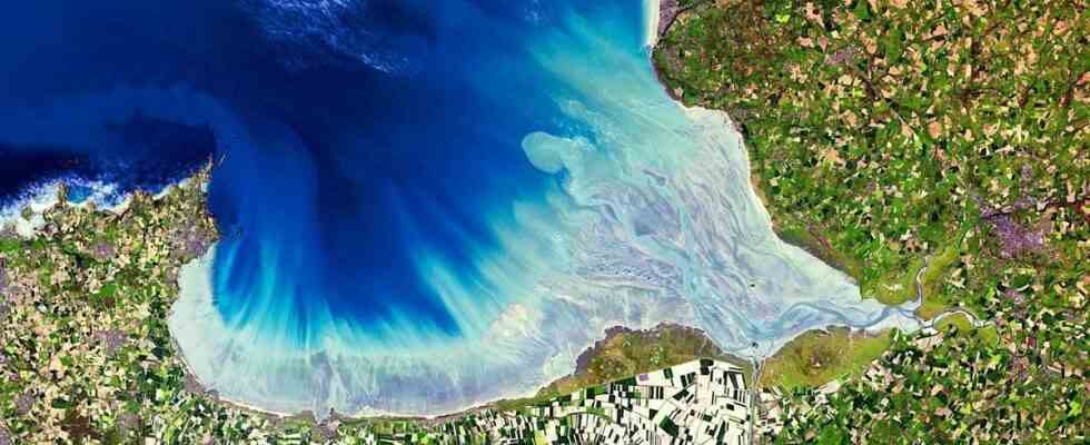
The photo is worth seeing. The program of the European Union Copernicus, which collects data on the environmental state of planet Earth, regularly publishes space photos taken from one of its satellites on social networks. One of them, broadcast on Sunday then highlighted this Monday by Meteo Franceoffers a spectacular view of the bay of Mont Saint Michel in fine weather.
The vibrant colors and contrasts surprise, whether it’s the ocean or the surrounding agricultural plots. It is easy to distinguish the towns of Cancale (Ille-et-Vilaine), Dol-de-Bretagne (Ille-et-Vilaine), Avranches (Manche), Jullouville (Manche). Without forgetting, of course, the famous Saint-Michel islet, to the south-east of the bay that bears his name, straddling the regions of Brittany and Normandy.
The snapshot had been taken on Saturday, specifies the Copernicus program.