RICHARD BOUHET / AFP
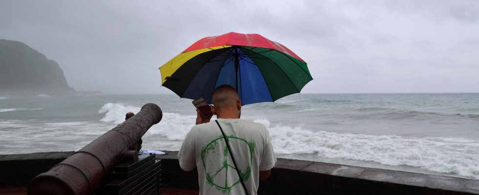
A resident stands on the seafront before the passage of Cyclone Belal, in Saint-Denis, on the island of Reunion, in the Indian Ocean, January 14, 2024.
WEATHER – The risk of devastating winds. Reunion Island, on red cyclone alert this Sunday, January 14, will move to purple alert, the maximum alert, this Monday, January 15 at 6 a.m. (3 a.m. in Paris), due to the imminent arrival of cyclone Belal , potentially devastating.
The purple level of the cyclone alert implies “strict confinement of the entire population, including emergency and security services”specifies a press release from the prefecture of this overseas department of some 870,000 inhabitants. “All circulation is formally prohibited for any reason whatsoever and until further notice,” it is indicated.

The prefect of the department had called on the population on Sunday to confine themselves from the beginning of the evening. “Reunion could experience a major, extremely dangerous cyclonic event in a few hours. I call on the people of Reunion to exercise the greatest caution. A severe test lies before us.”for her part indicated on Twitter the President of the Réunion Region, Huguette Bello.
Prime Minister Gabriel Attal has summoned a crisis unit for 7 p.m., while Météo France evokes a cyclone “who could make history” Of the reunion.
Already very impressive gusts and waves
The weather conditions were already deteriorating this Sunday at midday. Météo France reported “strong rainy episodes, sometimes stormy”gusts which “locally exceed 100 km/h” and waves 4 to 5 meters high. Some residents have also shared impressive videos, as you can see below.
In the next 24 hours, Météo France predicts gusts of more than 150 km/h “on the heights of the island”. “A direct impact (on Reunion Island) is not excluded, which would involve winds exceeding 220 km/h in the low areas and reaching 250 km/h in the high areas”, also warns Céline Jauffre, interregional director of Météo France. Whatever the scenario, “significant impacts linked to strong winds, heavy rain and cyclonic swells are expected”assures Météo France.
Céline Jauffre added this Sunday evening, during a press conference, that “the eye of the storm” could affect the island in the coming hours. At that time there may be a “lull, but it will not be the end of the cyclone, quite the contrary, because the winds could resume”, she warned. “ “We confirm that the level of threat is very significant,” she insisted.
Consequently, residents must “ devote the next few hours to doing nothing other than preparing for confinement”therefore insisted the prefect, in particular by ensuring “ of the place where we are going to shelter” and of “ the availability of its reserves ».
Also see on HuffPost: