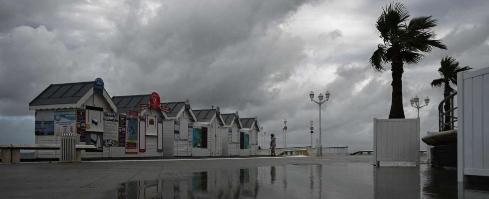
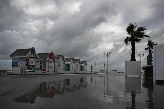
Three departments on red alert for “violent wind” on Thursday, thirty classified orange, including Paris and its region: a large quarter of north-west France is preparing to face the “very strong autumn storm” Ciaran, with gusts of up to 170 km/h associated with heavy rain. An event qualified as potential “weather bomb” by Météo-France.
The movement of heavy goods vehicles prohibited in Brittany on Thursday
The circulation of heavy goods vehicles will be banned in Brittany on Thursday, the Minister for Transport, Clément Beaune, announced on Wednesday. “We have taken measures via the prefectures to ban the circulation of heavy goods vehicles. Many were already banned since it is a public holiday, this will continue throughout the day tomorrow, particularly throughout the Brittany region”said the minister.
Mr. Beaune also invited motorists to respect a “absolute ban on driving” in the departments on red alert – Finistère, Côtes-d’Armor and Manche.
More than 3,000 firefighters mobilized
The Minister of the Interior, Gérald Darmanin, announced that 3,200 firefighters will be mobilized in the four Breton departments (Côtes-d’Armor, Ille-et-Vilaine, Finistère and Morbihan) as well as in Manche and Loire-Atlantique .
For the department of Finistère alone, which could be the most affected, more than 650 firefighters were mobilized for the night from Wednesday to Thursday compared to 250 usually, as well as more than 435 gendarmes, detailed the prefect Alain Espinasse during a briefing. press. Some 435 gendarmes are also mobilized with the support of two helicopters from the Rennes aerial section, for possible helicopter hoists.
Enedis also announced the sending of reinforcements to compensate for possible damage to the electricity networks and carry out rapid repairs.
TER interrupted in five regions on Thursday
The arrival of this powerful storm led the SNCF to announce the interruption for Thursday of all TER lines in the Brittany, Pays de la Loire, Normandy and Centre-Val de Loire regions, as well as in Hauts -of France. The TGVs will only run between Paris and Rennes for Brittany, without going as far as Brest, Quimper or Saint-Malo, said a spokesperson for SNCF Bretagne. Paris-Lille connections will be ensured.
Brest Bretagne airport will be closed from Wednesday 5 p.m. to Thursday 9:30 a.m. Boat connections with the islands will be very disrupted, or even completely suspended.
In Finistère, “avoid any travel after 8 p.m.”
The prefect of the department, Alain Espinasse, recalled, on Tuesday, the instructions for extreme vigilance, asking the population “avoid any travel after 8 p.m. and throughout the night”of “stay confined until the winds subside”, “to secure or shelter any object likely to constitute a danger of projection” and, finally, not to go to the coast, along rivers or in wooded areas. The population is finally invited to equip themselves with autonomous lighting means, such as a flashlight. All events likely to cause population movements had to be canceled and child care centers closed on Thursday morning. Traffic restrictions have also been decided, such as the closures of the Cornouaille bridge, which connects Bénodet to Combrit, and the Iroise bridge in Brest, from 10 p.m. this Wednesday.
Newsletter
” Human warmth “
How to face the climate challenge? Every week, our best articles on the subject
Register
To coordinate all relief operations, a departmental operational center (COD), under the authority of the prefect, must be activated from 5 p.m., this 1er november. For his part, Rear Admiral Cyril de Jaurias, deputy maritime prefect of the Atlantic zone, announced that the intervention, assistance and rescue tug (RIAS) Bourbon Bee was ready to intervene at sea, at the slightest request from the CROSS (operational surveillance and rescue centers) of Corsen and Etel. “All sailors were invited to take shelter at anchor, as the sea was forecast to be very rough with waves that could reach fifteen meters”he said during a press briefing on Tuesday.
In Granville (Manche), sites closed and fishing boats returned
In Granville, in Manche, the town hall announced the closure for twenty-four hours, from Wednesday 6 p.m., of certain risk sites. Located on the seafront or dotted with trees that could not withstand the storm and fall, the Plat-Gousset promenade, part of the gentle path linking the station to the city center or even the Christian-Dior garden will be prohibited to the public. “We have also postponed the start of certain agents who start very early in the morning, such as those from urban cleanliness, but otherwise people here are used to it, we mainly appeal to their common sense”supports Gilles Ménard, the mayor of the city.
Jacques, restaurateur at the marina, puts the event into perspective: “I’ve lived here since 1977 and we’ve seen plenty of storms. » Showing the exterior of the establishment, he explains: “We brought in the chairs and propped the tables to the side to prevent the wind from pushing the glass walls of the terrace, but I think that will be all. If it blows too hard then we’ll close, but we’re pretty used to it. »
On the fishermen’s side, the situation also seems familiar. “For the most part, we brought in the boats, doubled the strength of the moorings and put away all the equipment that could cause damage if it flew away. A bit like someone who would tidy up their terrace before very bad weather, ultimately”, says Baptiste, a 26-year-old fisherman. His colleague highlights the strong tide and the risk that certain moorings will jump. “In Jersey, they were forced to put sandbags to protect themselves. Here it’s different, we have several walls between the water and the city and we are higher. » One of them still plans to spend the night on his boat to intervene in the event of a problem.
In Cap-Ferret (Gironde), oyster farmers worried
In Cap-Ferret, in Gironde, it is calm before the (next) storm. After Aline and Céline, Ciaran and his surge of waves expected up to 8 meters are preparing to overflow onto the coasts of the very chic and very fragile peninsula which stretches between the Arcachon basin and the Atlantic Ocean .
The oyster farmers are holding their breath. Last weekend, with the high tides, the water rose very high. In Claouey, a small village at the entrance to the peninsula, the sandbars did not hold and several cabins were damaged. But what worries shellfish farming professionals above all is the future of the Banc d’Arguin. Jewel of the basin, this nature reserve which appears and disappears with the tides at the foot of the Pilat dune opposite the tip of Cap Ferret is also renowned for its oysters which are as abundant as they are refined. The Arguin bench was seriously attacked by storm Céline, which created a breach. Nearly two thirds of the concessions were affected: Céline took away numerous pockets and covered the parks of the southern conche under 3 to 4 meters of sand. “With Ciaran, what could still be saved will be lost”alarms Olivier Laurent, vice-president of the Cap-Ferret oyster farmers’ union.