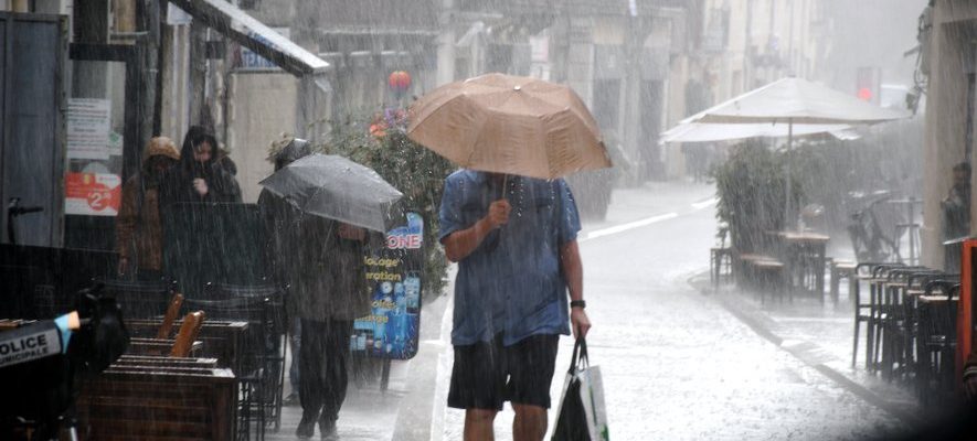
After moderate showers this Tuesday, October 17, the departments of Hérault, Gard and Ardèche will face heavy rain in the coming days due to an episode in the Cévennes.
“This is the classic pattern ofa Cevennes episode. The water in the Mediterranean is warmer than the temperature of the continent and therefore evaporates. If the conditions are favorable the rains will rise again and remain blocked above the Cévennes relief, thus causing heavy rains.” It is difficult to be more concise than the climate and atmosphere technician Cyril Wuest.
Heavy thunderstorms on Wednesday
While showers put a definitive end to summer temperatures on Tuesday, the forecast for the next few days is pessimistic. The sun is not expected to return anytime soon. Even worse, Hérault and Gard have been placed on orange alert for “rain and flooding” for the day of this Wednesday from 10 a.m.
Météo France expects “150 to 200 mm of precipitation in the Cévennes and their foothills, with possible peaks at 250 mm locally”. To compare, “what will fall in 48 hours is the equivalent of a month and a half. The rains will be stormy and will last for hours,” announces the meteorologist.
Thursday should be quieter. “Showers will still be present but less heavy,” explains Montpellier hydrologist Yves Tramblay. For this day, the maritime inlets responsible for the rains begin to shift towards the east. Hérault should be less concerned. “Alès will be much more impacted than Montpellier or Nîmes,” specifies Cyril Wuest.
Flood risks
The night from Thursday to Friday is likely to be eventful. Thunderstorms are forecast and could cause flooding. “There is risks of potential overflowsespecially in the areas affected on September 16 (where there had already been heavy rain, Editor’s note), particularly towards Lodève and Bédarieux”, analyzes Alix Roumagnac, meteorologist and founder of Predict Services, a Hérault-based company specializing in the climate.
At the same time, the showers should shift to the Paca region and calm down from Saturday. They could make it possible to “partially recharge groundwater which are at very low levels because of the drought this summer”, rejoices Yves Tramblay. However, when the rains are too intense, they “do not allow water to penetrate the water tables, nuance Cyril Wuest. The water then only runs off the surface.”
What’s next after this week of precipitation? “Possibly other Cévennes episodes, because the sea will remain warm. There is therefore the potential for further heavy rain if there are passing depressions,” concludes Alix Roumagnac.