severe weather situation
Also on Friday isolated thunderstorms and heavy rain – the map provides an overview
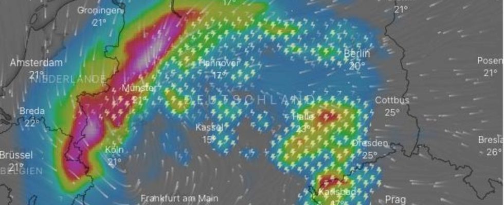
Thunderstorms and storms: The map shows the forecast for late Thursday evening. A current version can be found at the bottom of the article
© Screenshot windy.com
The German Weather Service (DWD) is still expecting isolated storms this Friday. The map below shows where severe weather is brewing.
Table of contents
After the severe storms in large parts of Germany, the German Weather Service is now warning of “partly heavy rain lasting several hours” in north-west Germany and in Mecklenburg with rainfall between 30 and 90 liters per square meter. In the east and southeast there could still be isolated thunderstorms with heavy rain, hail and stormy gusts, the DWD announced on Friday morning. In the course of Friday the weather will slowly calm down. On the night of Saturday, “probably no more warnings are required”.
Map: See live where thunderstorms are brewing
The interactive map below shows where it is currently lightning, thundering and raining. In addition, you can use the timeline at the bottom of the graphic to call up the forecast for a later point in time. At the top right, the displayed level can also be switched to rain or snow, for example.
The service is provided by Windy.com. The makers use the model from the “European Center for Medium-Range Weather Forecasts” for their representations and forecasts.
Sources: DWD
Tips on how to behave in thunderstorms

pictures of the day
naked frogs
In the gallery: The pictures of the day tell small and big stories from all over the world