eyes in space
Thanks to the satellite deal, Kyiv has a razor-sharp view of the Crimean Bridge – and other objects of military interest
A good view: the Crimean Bridge on an Iceeye satellite image
© Iceye
A contract signed by a private foundation gives the Ukrainian military access to satellite imagery. The value these can have became evident several times during the war.
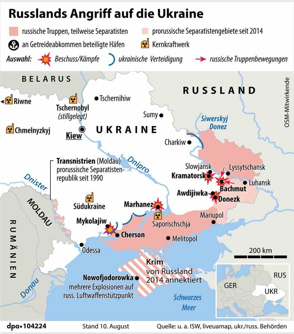
The Crimean Bridge is a thorn in the side of the Ukrainian leadership. Recently, an adviser to President Volodymyr Zelenskyj called for the “dismantling” of the prestigious building opened with great pomp by Russian President Vladimir Putin in 2018. “It doesn’t matter how: voluntarily or not,” he added, indirectly turning the bridge into a military target.
Thanks to the cooperation between the Serhiy Prytula Foundation and the Finnish satellite operator Iceye, the Ukrainian armed forces now at least have a pin-sharp view of the Crimean Bridge. And not just the bridge. As announced by Iceye, the foundation is providing the military with all the recordings from a radar satellite that has an overview of the entire region. In contrast to optical satellites, radar satellites can deliver good image results even in the dark and in bad weather conditions and thus also provide valuable information about Russian military stations or other objects of interest to Kyiv.
The founder of the foundation, Serhiy Prytula, is a Ukrainian television journalist and has run for political office several times in the past without success. Among other things, he wanted to be mayor of Kyiv, but lost out to Vitali Klitschko. For some time he has been raising money through donations and auctions to buy equipment for his country’s armed forces, including Turkish Bayraktar drones. At the auctions, works of art go under the hammer, but also on wreckage of downed Russian planes can be offered. The contract with Iceye is his latest coup.
War in Ukraine: Private satellite images make an important contribution
The value of private satellite images for reconnaissance and documentation in war has already been shown several times in the course of the Russian war of aggression against Ukraine. Recordings by the US company Maxar showed, among other things, a kilometer-long military convoy that was moving towards Kyiv after the start of the invasion. They are also helping to clarify the Butscha massacre.
As valuable as this commitment is for the various parties involved at many levels, it also entails risks for the company. By publishing and passing on the recordings, they are likely to arouse the displeasure of the Russian side, thereby turning their satellites and infrastructure into potential targets for sabotage and shooting. And how the US would react to the downing of an American – albeit commercial – satellite in space is an open question.
Sources:Iceye, Shot down in UA, Serhiy Prytula (Twitter), Defense Blog


