On the 44th day of the conflict, Russia continues to hit hard with a rocket attack on Kramatorsk station in eastern Ukraine on Friday morning. Nearly a week after the Boucha genocide and despite increasingly symbolic international sanctions, Vladimir Putin and his armies do not seem to calm things down. To understand the determination of the head of the Kremlin and the advance of Russian troops in Ukraine , 20 minutes takes stock in four infographics.
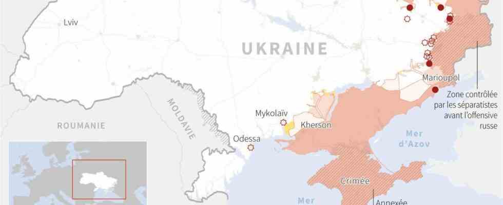
The situation in Ukraine on April 8
As since the start of the offensive on February 24, Russia is concentrating its war efforts on the Donbass region. Worried about this obsession with the east of the country, the Ukrainian authorities are trying to evacuate civilians from these regions. In the Donbass, evacuations of civilians continue in the face of fear of a permanent Russian offensive. Including under the bombs, as in Severodonetsk, where the front line is at the gates of the city.
Destruction in Mariupol
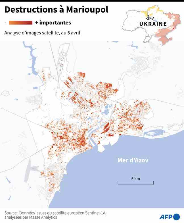
As this map shows, the city of Mariupol, one of the martyr cities of the Russian offensive, was partly destroyed. The pro-Russian separatist authorities have estimated the civilian losses in Mariupol at around 5,000 people and the housing destroyed at “60-70%” in this city which they have been besieging for weeks with the Russian army, and of which they admitted that the capture control “would take time”.
Destruction in Kharkiv
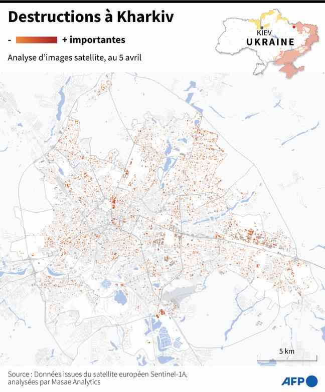
Like the city of Mariupol, that of Kharkiv, affected very early in the conflict, suffered greatly from Soviet attacks. With its 1.419 million inhabitants in 2017 according to the UN, Kharkiv is the second largest city in Ukraine. Administrative capital of Kharkiv Oblast (administrative subdivision of Ukraine), the eponymous city is located 423 km east of the capital, kyiv. Its proximity to the Russian border and its administrative weight in Ukrainian politics make it, after kyiv, a privileged target. The map above demonstrates this.
Russian strikes against Ukrainian strikes
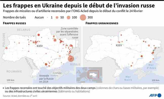
This infographic shows the glaring imbalance between Russian and Ukrainian strikes. The army of Vladimir Putin is illustrated, like its multiple attacks, as a real assailant, while the men of Volodymyr Zelensky apply a defensive strategy in order to block or recover occupied territories.