Status: 02/17/2022 02:53 am
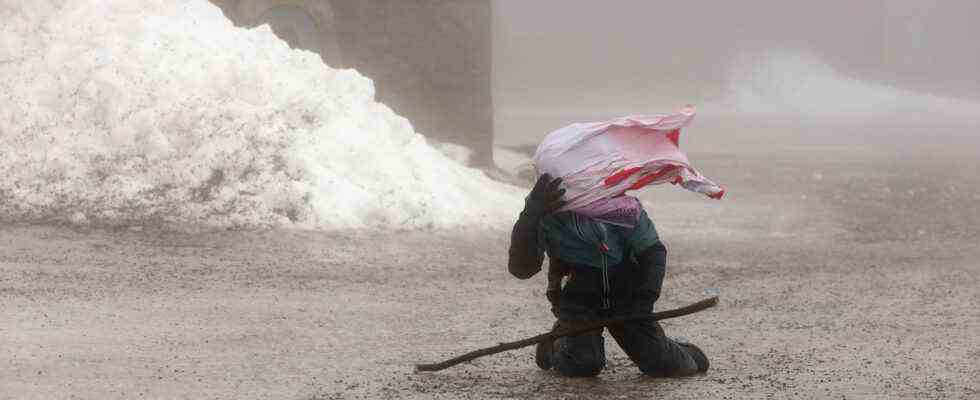
Storm low “Ylenia” is currently sweeping across Germany with hurricane gusts. Wind speeds of up to 152 kilometers per hour were measured on the Brocken. Lufthansa canceled various flights, and rail traffic is also affected.
It’s uncomfortable: The storm “Ylenia” moves over Germany at night, sometimes with hurricane gusts. According to the German Weather Service, average wind speeds of 120 kilometers per hour were measured between 12:30 a.m. and 1:00 a.m. on the exposed Brocken in the Harz Mountains. The peak wind during this period was 152 kilometers per hour.
In other parts of Germany, too, there were hurricane gusts and hurricane-like gusts in exposed locations such as mountain peaks: In the above-mentioned period, wind speeds of an average of 87 km/h were measured on the Feldberg in the Black Forest, with peaks of 125 km/h. There were heavy gusts of wind, for example, at Cape Arkona on Rügen (77 km/h, 105 km/h peak) and at the Kiel lighthouse (79 km/h, 101 km/h peak).
Weather Service issues severe weather warnings
The German Weather Service (DWD) in Offenbach had issued severe weather warnings for Wednesday evening to Thursday evening, mainly for the northern half of the country.
The DWD said it was a “full-fledged storm situation” in which rare wind speeds had to be expected in the lowlands.
Sebastian Duden, NDR, with impressions of the storm “Ylenia”
daily topics 10:30 p.m., 16.2.2022
Severe weather warnings also apply to mountainous areas in southern Germany, such as the Black Forest and the edge of the Alps. The weather service and the federal and state civil protection authorities warn of the dangers of uprooted trees, falling roof tiles and flying objects. Damage to buildings is just as possible as disruption to traffic.
States make school attendance free
In North Rhine-Westphalia, state school minister Yvonne Gebauer canceled classes for Thursday. Lessons have also been canceled in some municipalities in Lower Saxony. Rhineland-Palatinate and Saarland made school attendance optional. This means that parents and adult students can decide for themselves whether the way to school is reasonable. Schleswig-Holstein and Hesse have also decided to take this step, as has Bavaria. Bremen announced digital distance learning for Thursday.
Storm surge danger on the North Sea
The Federal Maritime and Hydrographic Agency (BSH) warned of the danger of a storm surge for the North Sea coast. On the North Frisian coast and in the Weser and Elbe area, the flood will be 1 to 1.5 meters higher than normal, as the BSH announced.
In the Hamburg Elbe area, it is likely to reach values that are 1.5 to 2 meters higher than the average high water level. The storm surge danger exists until about 5 a.m. in the morning.
Danger of flooding in Thuringia
Floods were also warned in Thuringia, for example in parts of Sonneberg. “Bring personal valuables to higher parts of the building. Turn off electricity and heating in endangered rooms. There is already a risk of electric shock with condensation,” said a statement from the Thuringia State Police Directorate. People in parts of the city of Schleusingen had already prepared for possible flooding of the Werra tributary lock.
Numerous volunteers helped to fill around 2000 sandbags, as the spokesman for the Hildburghausen district office, Tim Pechauf, said.
Obstacles in rail traffic
Fallen trees already led to the first obstacles in rail traffic during the night. However, the extent was initially limited. A tree fell on the tracks near Buchholz (Nordheide) between Bremen and Hamburg. An ICE therefore had to be diverted, as a railway spokesman said. Long-distance trains would now be held back at suitable stations and initially wait, it said. According to the company, trees in North Rhine-Westphalia blocked isolated side routes in the Dortmund area. The Dortmund-Münster connection was temporarily affected.
Deutsche Bahn had warned passengers on Wednesday about delays and train cancellations during the storm. Anyone who postpones their trip because of the storm can use the ticket they have already booked flexibly up to seven days after the end of the disruption or cancel it free of charge.
According to the ADAC in North Rhine-Westphalia, motorists should leave their cars where they are and avoid trips that are not absolutely necessary. Fallen trees or branches must be expected at any time.
The storm also affects air traffic in the morning. Lufthansa has so far canceled 20 flights as a precaution, as the company announced during the night on request. Passengers are advised to check the airline’s website for the status of their flight. According to the operator, connections to Berlin, Hamburg and Munich are affected at the largest German airport in Frankfurt
Ski resorts are preparing for the storm
The Mitte district of Berlin warned “expressly and urgently” against entering parks because of rotten trees. Numerous zoos, for example in Berlin, Wuppertal in North Rhine-Westphalia and in Magdeburg in Saxony-Anhalt, should remain closed as a precaution.
Many ski areas also prepared for the hurricane lows. The suspension railway on the Fichtelberg in Saxony was already standing still. Because of the risk of tree breakage, some trails are to be closed.
Low “Ylenia” is followed by low “Zeynep”
From Thursday afternoon, the wind from low “Ylenia” will slowly decrease, according to DWD information. However, the breather should only be brief. The next hurricane – called “Zeynep” – is expected to come from the British Isles as early as Friday.
According to the DWD, the northern half in particular will probably be affected again. But the forecasts are not entirely certain: “The models still have very different simulations,” said DWD spokesman Andreas Friedrich. The weather situation is very dynamic.
“A Chain of Storm Lows”
At the end of January, the storm “Nadia” swept through northern and eastern Germany with dangerous gusts and caused millions in damage. In Beelitz, Brandenburg, a pedestrian died because a large election poster was blown over and fell on him.
About a week later, the foothills of storm “Roxana” swept over parts of Germany. According to the DWD meteorologist Friedrich, the expected storms are comparable to low “Nadia” in terms of wind peaks. From his point of view, however, the current situation is more explosive, “because we have a chain of storm lows”.
Karsten Schwanke, meteorologist, with information about the severe storm low over Germany
tagesschau24 9:45 p.m., 16.2.2022