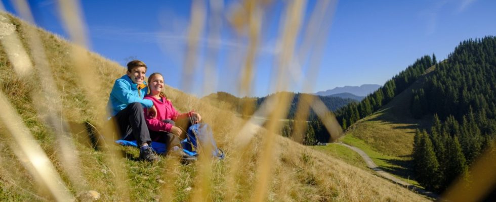
The mountain calls – all the stronger in spring after a long, often mountain-poor winter. Many hikes, especially at lower altitudes or on the south-facing side, are now possible without any problems, but caution is still advised: there is often still snow in the mountains, which can make hiking slippery or even dangerous. It is advisable to have Grödel and sticks with you as well as warm clothing, as it is often colder at altitude than in the valley. Which mountain tours are suitable for spring – a selection, sorted by altitude:
Großer Illing (1340 meters) near Ohlstadt
If the tour up the Heimgarten, Ohlstadt’s local mountain, is too strenuous after the winter, the Großer Illing is a good alternative. The hiker covers most of the route along the Kaltwasserlaine mountain stream. It starts at the parking lot at the end of Heimgartenstrasse. After about a quarter of an hour along the stream you come to the forest road, but you only follow it briefly and keep right at a fork.
We walk along the stream for an hour until the path forks. To the Großer Illing you turn left and at the next opportunity with the signs Rötelstein turn right again. After the fork, the path branches off into the forest towards Illing.
- Directions: via the A95 to Ohlstadt; Park there at the end of Heimgartenstrasse. Or take the train from Munich to Ohlstadt, then walk to the starting point.
- Walking time (up and down): 3 hours
- Elevation difference: 600 meters
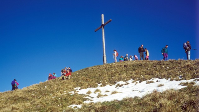
Hörnle (1550 meters) near Bad Kohlgrub
A classic – and understandably so: the hike to the Hörnle near Bad Kohlgrub is easy and therefore ideal for beginners. From the parking lot at the valley station, a wide path leads, sometimes steeper and sometimes flatter, through the forest to the mountain station and to the viewing platform of the Zeitberg, where the surrounding peaks are explained. You can then continue hiking towards the Vorderes, Mittleres or Hinteres Hörnle on a wide forest path. The popular Hörnlehütte, where people like to stop off on the way back, is closed for a long time due to renovation, the Hörnlebahn is currently not running due to maintenance.
- Directions: via the A95 and Murnau to Bad Kohlgrub, parking at the Hörnle valley station in the Sonnen district. Or take the train from Munich to Murnau, then take the rail replacement service towards Oberammergau to Bad Kohlgrub.
- Walking time (up and down): 3.5 hours
- Elevation difference: 630 meters
Jägerkamp (1750 meters) on Spitzing
The Jägerkamp is often viewed as a mountain that you can take with you on the way to Aiplspitz; The Jägerkamp is a nice destination, especially in spring, when your fitness is not yet the best after the winter. From the Spitzingsattel follow the signs to the Schönfeldhütte. The path initially leads through the forest, where it can be slippery when it is wet. Once you have passed the Schönfeldhütte (opens at the end of April), the path leads up a grassy slope. Once at the top, it’s not far to the Jägerkamp on the left.
- Directions: via the A8 and the Schliersee up to the Spitzingsattel; There is parking there. Or take the Bavarian Regiobahn to Schliersee and change there to the bus towards Spitzingsee. Get off at the Spitzingsattel stop.
- Walking time (up and down): 3 hours
- Elevation difference: approx. 650 meters
Schafkopf (1380 meters) near Farchant
This hike can be easily reached by train. You first hike along the Spielleitenweg to the playground at the edge of the forest, which is very nice for children. There you cross a small watercourse and gain altitude via a beautiful forest path. The path to Schafkopf is well signposted, and for a short time you hike on a forest path. At the end it gets steep again, here you zigzag on steep grassy slopes towards the mountain. It is essential to make sure that the passage is free of snow.
- Directions: via the A95 to Garmisch-Partenkirchen, parking in Spielleitenweg. Or take the train from Munich towards Garmisch-Partenkirchen to Farchant.
- Walking time (up and down): 3.5-4 hours
- Elevation difference: 700 meters
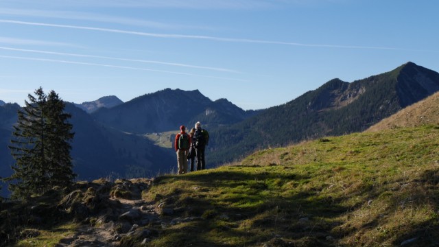
Seekarkreuz (1600 meters) near Lenggries

A beautiful spring tour is the Seekarkreuz near Lenggries. Anyone who descends via the Lenggrieser Hütte can then return there; However, it is currently company vacation. But a snack on the sunny summit with a view of the Karwendel is a more than worthy alternative. From the parking lot at Hohenburg Castle in Lenggries you walk towards the Grasleitensteig, first past meadows to a farm where you keep to the left. Follow the signs to the Lenggrieser Hütte, where you follow the path to the right to the summit.
- Directions: via the A8 or A95 to Bad Tölz and on to Lenggries, park at the Hohenburg car park. Or take the Bavarian Regiobahn to Lenggries and from there walk about two kilometers to the starting point.
- Walking time (up and down): just under 5 hours
- Elevation difference: 900 meters
Wank (1780 meters) near Garmisch-Partenkirchen
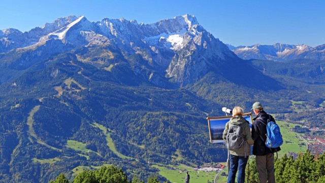
From Wank you can look directly at the Wetterstein Mountains with Germany’s highest mountain, the Zugspitze.
(Photo: imageBROKER/Günter Gräfenhain/imago/imagebroker)
In summer the sun beats down quite a bit on the south side; In spring, when it is not yet so intense, the warmth comes in handy. And it has the advantage that the snow melts quickly in spring. The path first leads to the Schalmei Gorge and over the Tannenhütte and Eckenhütte towards the summit. Once at the top there is a great view of the Zugspitze massif. With around 1000 meters of altitude, a tour for the more ambitious spring hikers.
- Directions: via the A 95 to Garmisch-Partenkirchen, parking is possible, for example, in Wankweg. Or take the train from Munich to Garmisch-Partenkirchen and by city bus Drive in the direction of the Klinikum to the “Historische Ludwigstrasse” stop.
- Walking time (up and down): 5-5.5 hours
- Elevation difference: 1000 meters