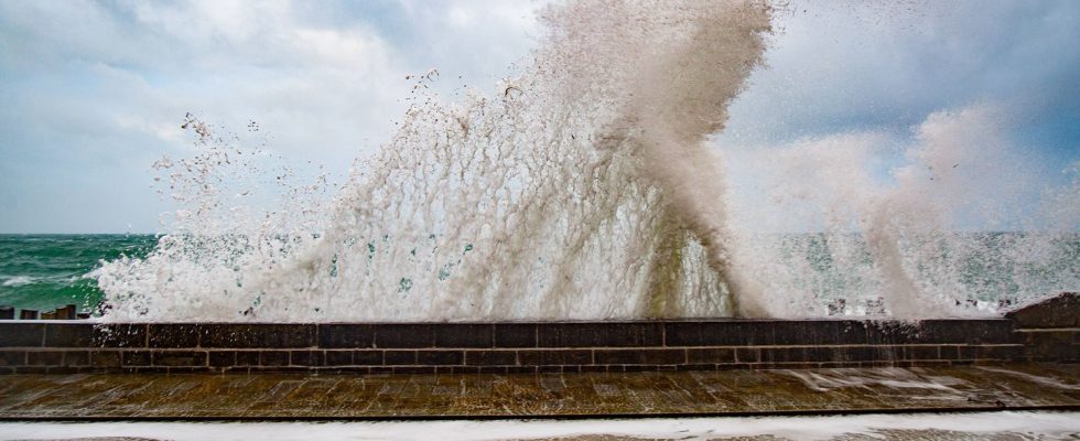
More than two weeks after deadly floods in the south of France, Météo-France announces a new meteorological episode in part of Occitanie this Tuesday. The Hérault coastline will be placed on orange wave-submersion vigilance from 6 a.m. until noon.
“East to southeast winds strengthen late Monday to Tuesday night over the northern Gulf of Lion. They generate strong waves from the east to the southeast reaching the coast of Languedoc at the end of the night, explains Météo-France. Atmospheric conditions are the cause of a significant rise in sea level. The breaking of these strong waves, associated with these high sea levels, risks causing submersion by crossing sea waves on the exposed areas of the littoral. »
Hérault will also be on yellow alert for “rain, flood” and “wind” on Tuesday. Accumulations “should reach 30 to 50 mm on average, with peaks of 80 mm in the plains and up to 120 mm in the Cévennes. » Wind gusts could reach 90 to 100 km/h. In addition to Hérault, 24 departments will be placed on yellow alert, some for several parameters.
“Don’t go to the beaches”
“Be extremely careful on the coast. During the orange phase: do not go to sea, do not get into the water and stop all water activities,” warns the Hérault prefecture. “Be careful of the wave-submersion phenomenon: do not go to beaches and submersible routes. »
These very complicated weather conditions have already led to the cancellation of the big Escale parade in Sète. The arrival of the Bélem, the Morgenster, the Nao and the many other sumptuous ships which will anchor in the Hérault port until April 1st has been postponed by a few hours, when conditions will be more clement.
These alerts come almost two weeks after the floods which caused the death of eight people – six in Gard, one in Hérault and one in Ardèche. The majority of these victims were swept away by swollen rivers while crossing submersible bridges.