geophysics
Magnitude 3 earthquake at Vesuvius
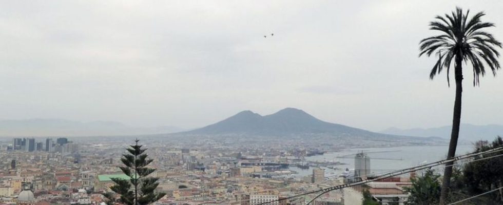
View from Castel Sant’Elmo of the city and the volcano Vesuvius. photo
© Alexandra Stahl/dpa-tmn/dpa
The earth shook around the Italian volcano Vesuvius. The tremors were also felt in several districts of Naples. Initially, nothing was known about any injuries or major damage.
According to the Naples-based research center, the epicenter was on the slopes of the volcano, in a densely populated area not far from the city to the east. It was registered at a depth of 2.9 kilometers. The 1,281 meter high Vesuvius is the local mountain of the city with more than 900,000 inhabitants. It also dominates the Gulf of Naples. A smaller earthquake of magnitude 1.4 had already been registered on Saturday evening.
Last eruption 80 years ago
The volcano’s last eruption was almost 80 years ago to the day: it began on March 18, 1944 and lasted ten days. Despite the evacuation of more than 10,000 people, there were 26 deaths. In 79 AD, after several eruptions of Mount Vesuvius, ash, mud and lava buried the ancient city of Pompeii. The complex is now one of the most visited attractions in Italy.
Actually, another earthquake zone in the densely populated region is considered dangerous, the Campi Flegrei, literally translated: the Burning Fields – a total area of 150 square kilometers that extends both on land and in the sea. There was a magnitude 3.4 earthquake in the sea there on March 3rd.