Status: 12.10.2022 8:25 a.m
Heavy rain, floods and flash floods – due to climate change, extreme weather events will be more frequent in the future. With flood protection, an app should now help to identify unknown danger spots in advance.
By Frank Groteluschen
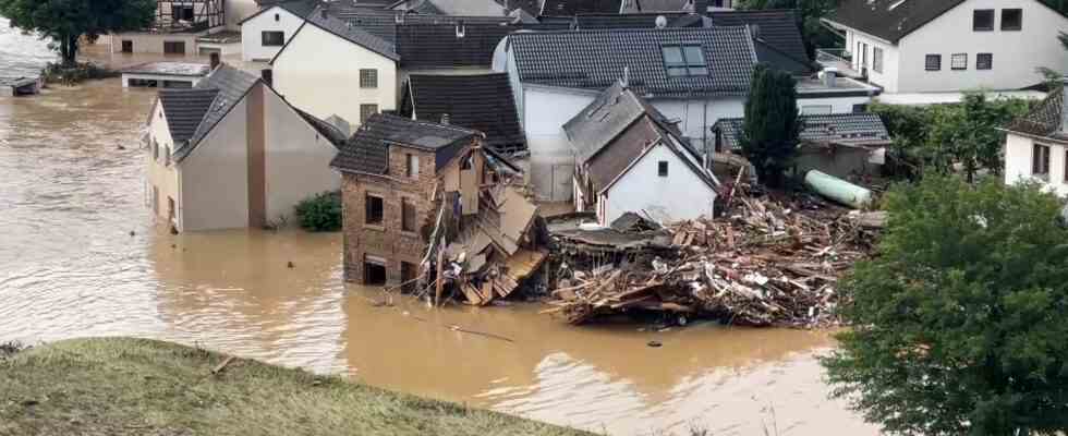
July 2021, the flood disaster in the Ahr Valley: More than 130 people die and around 500 buildings are destroyed. The effects are also so disastrous because some houses, roads and bridges are built in an unfavorable way: In heavy rain, they impede the rapid drainage of the water masses, and a flood turns into a flash flood. Even small causes can have significant consequences, such as a barrier in a stream. According to Katharina Haupenthal from the Trier University of Applied Sciences, flotsam, which is washed up in the event of heavy rain, then gets stuck in front of this grid. As a result, the water rises and flows into the gardens.
Robot to search for waterfalls
There are many such obstacles where water accumulates and cannot flow away. But by no means all of them are known and mapped – and therefore cannot be systematically eliminated. That’s why a research team from Trier and Koblenz is now working on techniques to identify such obstacles more precisely. A small rover is to search for potential waterfalls in risk areas using a laser scanner.
According to Haupenthal, the idea is that he can drive through the streets and recognize bumps in sidewalks, in streets, in small structural conditions. You could see, for example, where there are problems, where is the water drained into the basement of a house? And where would the community have to change something?
Residents can report danger spots
A second technique requires the cooperation of local residents: they often know best where the water is accumulating in their area when it is pouring heavily. The idea: people should use a smartphone app to report to the authorities if they have discovered a critical spot. A first version is already finished, says Haupenthal and points to her smartphone. “The app can record my location. And via an input mask, there is the option of selecting the type of problem, for example ‘blockage due to deposits’.” Users can also enter a short problem report, photograph the obstacle and then send it to the operator.
Sounds pretty easy – but there are some pitfalls. According to Haupenthal, how do you know that information is correct? When people feed in data just for fun, to try, it skews the results.
Plausibility check for data
To avoid this, the experts want to check the quality of the data for plausibility themselves, which should be enough to unmask possible pranksters. Later, this could be done automatically by software. The project will run until early 2025, when Haupenthal and her colleagues want to present an app that is ready for use. The idea is actually to be able to give the municipalities a kind of tool box. Tools that allow them to display their hazard maps in higher resolution.
One of the partner municipalities is the municipality of Altenahr. It is true that she currently has more pressing problems than developing a smartphone app. In the long term, however, the new technology could definitely help ensure that extreme rain does not have as catastrophic consequences as in summer 2021.