Tag: satellite imagery
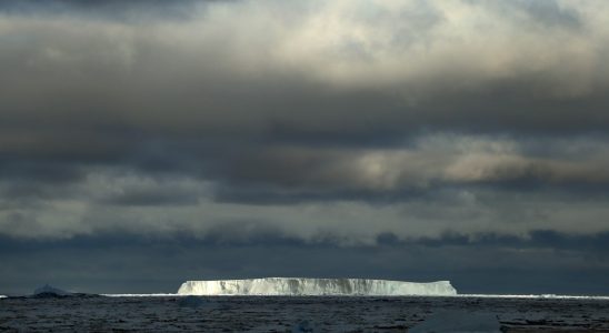
I Was There as the World’s Widest Glacier Split Apart
Out on the bow of the R/V Nathaniel B. Palmer, the air is dense and almost warm. We have punched through miles of Antarctic ice floes to reach the Amundsen Sea’s foggy interior. I want to honor the remaining distance between us and Thwaites Glacier’s calving front––this place that many scientists suggest could make a catastrophic impact on global sea levels but that no one, as of this moment in February of 2019, had ever before visited by ship––and yet
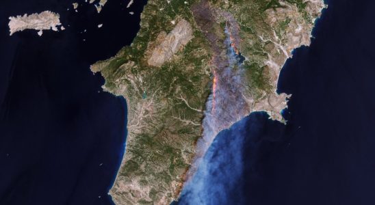
Astonishing images show Greece wildfires from space
Residents and thousands of vacationers have spent recent days fleeing wildfires in parts of Greece, with dramatic news images showing