The intense tropical cyclone Batsirai slows down and remains near our coasts this Thursday, February 3, 205 km, north of the island. According to Météo France Réunion, “the worst is yet to come” with the rear part of the system. The rains and the wind will intensify further. Reunion is still on hurricane alert.
•
The intense tropical cyclone Batsirai is taking its time off Reunion this Thursday, February 3. At 7 a.m., he was 205 km from our shores. It has slowed down and is moving at 6 km/h. According to Météo France Réunion, the rains and the wind will further intensify, “the worst is yet to come” with the rear part of the system. On red hurricane alert since 7 p.m. last night, Reunion is confined. The population must not go out and must keep informed of the evolution of the situation.
Follow our live on the situation here:
9:45 a.m. At this time, 36,000 homes without electricity
All municipalities in the territory are impacted and the municipalities mainly affected are: Les Avirons, Saint-Leu, Etang-Salé, Sainte-Suzanne, Saint-André, Saint-Benoît, Saint-Denis, Saint-Louis, Cilaos, Bras -Panon and the Plaine-des-Palmistes.
The passage of Cyclone Batsirai on the territory impacts 61,000 customers. Thanks to the mobilization of EDF teams, 25,000 customers were able to be resupplied via remote manoeuvres. 36,000 customers are currently without electricity (9% of our customers).
EDF in Reunion reminds you that in no way should you approach or touch a cable that has fallen to the ground because of the risk of electrocution.
To report an emergency situation presenting a risk to the person, contact the breakdown service: 0800 333 974
9:30 a.m. At this time, 30,000 people deprived of water
This Thursday morning, 30,000 people are deprived of water in Reunion in several municipalities.
Here is Runéo’s press release:
In Saint-Denis, following a break in the power supply, service disruptions, even cuts are in progress in the following sector: Quinquina.
In Bras-Panon, the weather conditions led to a deterioration in the quality of the water. Residents should take precautions to: not use the water for drinking or food preparation; favor non-food uses (toilet, WC, cleaning, etc.); prefer drinking bottled water.
In Saint-Louis, disruptions or even cuts are underway in the La Ferme sector. At L’Etang-Salé, in the Lambert Les Hauts sector.
9:20 a.m. “The worst is yet to come”, assures the prefect
“The worst is to come with heavy rainfall, assures Jacques Billant, prefect of Reunion. It remains dangerous, because it will still generate heavy rain, wind and swell, even as it moves away. The red alert remains in full effect, stay confined”.
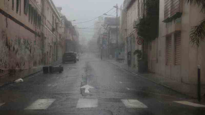
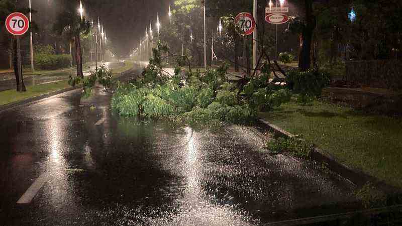
Cyclone Batsirai is near Reunion, the streets of Saint-Denis.
•
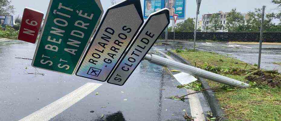
9:15 a.m. No reopening of the Coastal Route
Affected by the swell, the coastal road will be open when all the necessary reconnaissance has been done, so not before Friday evening or Saturday morning at best.
Cyclone Batsirai is near La Réunion, the entrance to the coastal road currently closed.
•
9:14 a.m. 12 injured according to a provisional report
A provisional assessment reports 12 injured, there is no victim related to the phenomenon. Among these 12 people in relative emergency, 10 were poisoned by carbon monoxide, an electrified firefighter following a roof fire and one injured following a fall from a roof. There were 25 cyclone-related interventions. The emergency services are in little demand and the confinement is very well respected by the people of Reunion.
9:12 a.m. Raw vigilance on six rivers
Six rivers are in yellow vigilance and could go into orange vigilance in the middle of the day with a serious risk of flooding, according to the prefect of Reunion.
9:10 a.m. No return to school until Monday
During the press briefing, the prefect of Reunion, announces that the return to school will take place on Monday and not before because of the cyclonic conditions which persist on the island.
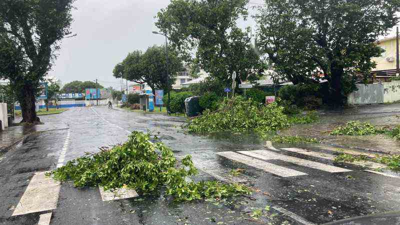
Cyclone Batsirai is near Reunion, downtown Saint-Denis.
•
9:01 a.m. “No victim to deplore for the moment, 12 injured, 25 rescue operations”
The prefect of Reunion, Jacques Billant, holds a press conference on the situation in the department.
“Batsirai is moving slowly at about 6km/h north of the island. Over the next few hours, it will skirt the island at a distance of between 180 and 200km. It remains dangerous, as it will still generate heavy rain, wind and swell, even when moving away.
The red alert remains in full effect, stay confined, due to the heavy rains that will fall on the island in the coming hours. I salute the civility of the Reunionese who perfectly respect the confinement instructions.
No casualties are to be deplored at this time.
12 injured in relative emergency, including 10 poisoned by carbon monoxide, an electrified firefighter following a roof fire and one injured following the fall of a roof. We count only 25 interventions linked to the cyclone”.
9 a.m. Live on Réunion La 1ère radio, TV, internet
Réunion La 1ère accompanies you on radio, TV and on the internet. You can reach us on 02 62 99 2000.
8:50 a.m. The prefect will speak at 9 a.m.
The prefect of Reunion, Jacques Billant, must speak at 9 a.m., live on the situation in the department. Reunion remains on red hurricane alert. More winds and rains are coming in the coming hours, including in the west which has been spared so far.
8:35 a.m. Batsirai at 205 km at 7am
Cyclone Batsirai takes its time off Reunion. It is 205 km away and travels at 6 km/h. According to Météo France Réunion, Cyclone Batsirai will stay off Réunion for several hours.
“The system is moving slowly and will be 180 or 200 km from our shores for several hours., explains Philippe Caroff, head forecaster at Météo France Réunion. IHe does not stand still, but moves very slowly. It will still get very slightly closer to the north of the island and the weather conditions will remain degraded”.
“It will be closest in the morning, but we are affected by the periphery of the system so it does not change anything, continues Philippe Caroff. In terms of rains, the biggest is to come, because they will arrive with the rear part of the phenomenon which will be very active. In other sectors, the weather will deteriorate in areas of the Port and possession at the end of the day. The northeastern half of the island will be affected by the rains to come at the end of the afternoon.
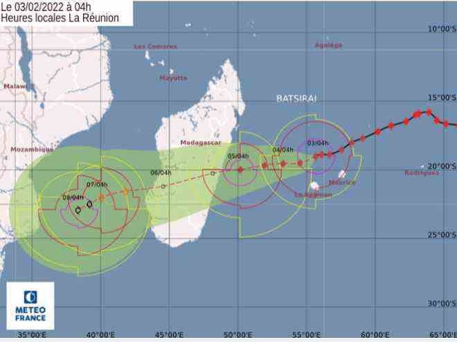
Batsirai’s forecast trajectory at 4 o’clock.
•
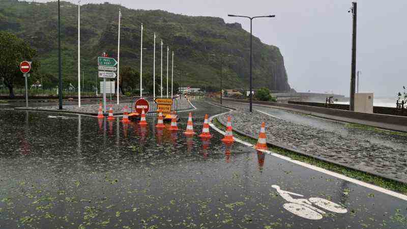
8:32. Vigilance Waves-submersion
Batsirai generates a cyclonic swell that breaks on the Reunion coast. With the progression of the system, from North-East, it gradually turns North then North-West. The northern swell associated with the cyclone reaches 5 to 6 meters with a total sea between 6 and 8m.
The maximum waves can then reach 10 to 12m. The most impacted areas are the east and north coast from Saint-Joseph to Pointe des Galets and extending to the north-west and west during the day. The swell will begin to subside overnight from Thursday to Friday but will remain significant between Pointe du Gouffre and Pointe au Sel.
8:30 a.m. Reunion is on red alert
Do not go out under any circumstances, Reunion is confined during the red alert. The safety instructions are as follows:
Stay at home until further notice;
- Do not move;
- Do not put yourself in danger (especially to take pictures);
- Use the phone only when absolutely necessary;
- Stay calm and listen to weather reports and official instructions relayed by local radio and television as well as information websites;
- Be alert to the risk of carbon monoxide poisoning.
- As a reminder: number of the public information unit: 09 70 80 90 40.
South Boulevard of Saint Denis
•
8:20 a.m. Send us your photos and videos
From home and with caution, you can send us our photos and videos on the WhatsApp number: 06 93 66 93 72.
8:10 a.m. 36,000 EDF customers affected by power cuts
All municipalities in the territory are impacted and the municipalities mainly affected are: Les Avirons, Saint-Leu, Etang-Salé, Sainte-Suzanne, Saint-André, Saint-Benoît, Saint-Denis, Saint-Louis, Cilaos, Bras -Panon and the Plaine-des-Palmistes.
The passage of Cyclone Batsirai on the territory impacts 61,000 customers. Thanks to the mobilization of EDF teams, 25,000 customers were able to be resupplied via remote manoeuvres. 36,000 of our customers are currently without electricity (9% of our customers).
EDF in Reunion reminds you that in no way should you approach or touch a cable that has fallen to the ground because of the risk of electrocution.
To report an emergency situation presenting a risk to the person, contact the breakdown service: 0800 333 974
8 a.m. Monitoring of water cuts
In several municipalities on the island, the distribution companies decided to cut off the water at the time of the passage on red alert, at 7 p.m. on Wednesday. The water is cut off at St Leu, at Avirons, at Entre Deux, at Le Tampon, at St Philippe and on part of St Joseph. It should also be interrupted tonight at Etang Salé. Preventive cuts have also been put in place in the east at Ste Rose and Plaine des Palmistes.
The aim is to prevent the pumping installations from being damaged during the passage of the cyclone (essentially the electrical and electronic part of the infrastructures) in order to be able to restart distribution as soon as the red alert is lifted. The idea is that it is better to deprive subscribers of water for a few hours than for several days if the installations have to be repaired.
Find our previous live from 5 a.m. to 9 a.m. by clicking here.
Find our previous live from 00h to 5h by clicking here.
Find our previous live from 5 p.m. to 12 a.m. by clicking here.