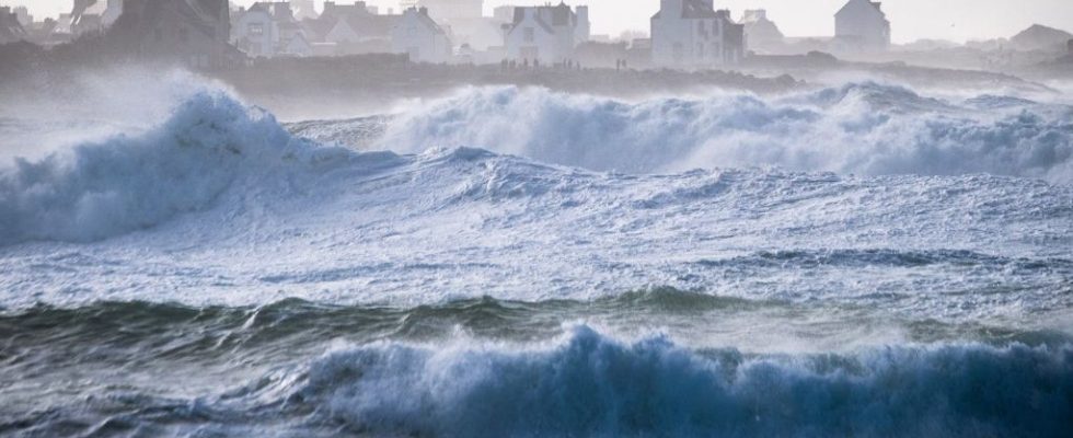
They were certainly not at the level of the Ciaran and Domingos storms that passed in November. However, storm Isha blew across the northern half of France during the night from Sunday to Monday. Gusts of up to 140 km/h were recorded in the Channel, reports Meteo France. The wind also blew at more than 100 km/h in the departments of Finistère and Côtes d’Armor.
This Monday, the intensity of the storm should gradually decline. Around forty departments are still placed on yellow alert for strong winds, Météo France alert. The regions of Brittany, Normandy, Hauts-de-France, Ile-de-France, Centre-Val-de-Loire, Bourgogne Franche-Comté and Grand Est are affected.
This Monday morning, the passage of the depression had not a priori left too many scars in the region, which had been placed on yellow alert for violent winds. In Ille-et-Vilaine, firefighters noted only a few minor interventions for fallen trees. An assessment which remains to be confirmed.
In the first part of the day, the southwest to west wind could again blow in gusts of 70 to 90 km/h over the northern half, locally 100 on the Channel coasts. It will drop a notch in the afternoon, but gusts of 60 to 80 km/h will remain possible on the terrain of the Massif Central, in the northeast and along the Channel coast.
The cold goes away
Temperature-wise, it’s time for a warm spell. Frosts will be weaker and localized, with minimums between -2 and +3 degrees from southern Aquitaine to the eastern borders, locally -2 to -4 degrees in the Mediterranean hinterland. It is very mild this morning from Brittany and Lower Normandy to the Pays de Loire with 7 to 11 degrees, elsewhere the minimums will range from 2 to 7 degrees. The maximums will generally reach 7 to 12 degrees, or even 12 to 16 degrees on the Atlantic coast, at the foot of the Pyrenees and around the Big Blue.