Source or cumulus clouds (Latin: Cumulus) are clouds with a predominantly vertical extent (in contrast to layered clouds, Latin: Stratus). How high they can grow depends on the vertical change in temperature and humidity. If they become correspondingly powerful, they eventually produce showers and thunderstorms.
The typical daily course of high pressure during the warm season often shows the formation of cumulus clouds from late morning after a cloudless night and a sunny morning. These fine weather clouds (cumulus humilis) usually dissipate again in the evening. The trigger for this cloud formation is the strong heating of air layers close to the ground by the sun. Warm air bubbles can then be released from there, rise up due to their buoyancy and continue to cool down. Until the water vapor that is part of the air eventually condenses and a cloud begins to form. However, if there is warmer air at higher altitudes, the ascent is stopped prematurely due to lack of lift and it remains cloudless.
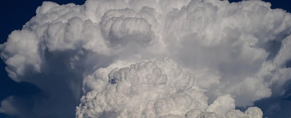
Cumulus clouds from which showers fall are towering cumulus clouds (cumulus congestus). Such a single cloud tower often has the appearance of a cauliflower, and initially shows sharp cloud edges, which quickly dull as they develop, for example when the top of the cloud freezes and takes on the shape of an anvil (cumulonimbus).
A prerequisite for the formation of such shower and thunderclouds is a sufficiently strong decrease in temperature with altitude. High humidity also has a positive effect. For precipitation to occur at all, the upper part of the clouds should reach a temperature of around -15 degrees or less. Hail or sleet can be expected at a cloud top temperature of -45 degrees or below.
In summer, the way for individual showers and thunderstorms can already be paved by the strong heating of the air layers near the ground during the day. However, they generally only occur when a warm, moist air mass is forced to rise over a large area, for example in the run-up to an approaching cold front.