After the massive eruption of a submarine volcano Hunga Tonga-Hunga Ha’apai in the island nation of Tonga in the South Pacific, the extent of damage, destruction and the number of victims remains unclear.
However, newly published satellite images give an idea of the consequences of the catastrophe.
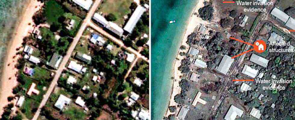
The International Charter for Outer Space and Natural Disasters compares old and new space images as part of a damage assessment. The before and after comparison gives an insight into the situation on site.
The images from the region show damaged buildings and infrastructure. Whole streets and buildings seem to have disappeared in the disaster.
The layer of ash reportedly covering many islands can also be seen from space. Images that used to be colorful now look almost like black and white shots.
The volcanic island itself is separated into two individual islands by the eruption. During an outbreak in 2014, they had grown together.
The eruption of Hunga Tonga-Hunga Ha’apai resulted in a massive ash plume several kilometers high.
The underwater volcano also triggered tsunami waves when it erupted, which were also felt in Japan, the USA and South America.
Geochemist Oliver Nebel told Australian broadcaster ABC that he believes the volcano will erupt again in the coming months. However, it is not possible to predict whether another outbreak will have the same strength.
Due to the collapse of various communication systems, the exact assessment of the situation on site is difficult. Even communication via satellite phones does not yet provide a clear picture of the situation in the Polynesian kingdom, which consists of 172 named islands in the South Pacific.