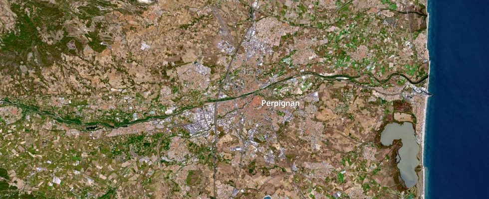
The European Commission has published a photo of the Pyrénées-Orientales taken by a satellite. The image is striking. The largely dominant brown color and the virtual disappearance of green spaces evoke the consequences of the historic drought that has affected Perpignan and the Roussillon plain for more than a year.
The image was taken on May 2 by the Sentinel-2 satellite. This device is part of the European space program Copernicus, initiated since the end of the 1990s and which collects data to observe the evolution of the Earth. It was published the day before the department went into a water crisis situation.
In two years, an unrecognizable landscape
At the beginning of March, an equally striking video taken by satellites was published on social networks by the European Commission: it was the same territory photographed two years apart, at the end of winter.
The extent of the drought around Corbère-les-Cabanes, one of the four municipalities in the department deprived of drinking water for several weeks, then appeared spectacularly.