Severe storms expected
Isolated tornadoes possible – maps show where storms and thunderstorms are approaching
The German Weather Service predicts heavy thunderstorms and storms for Tuesday
© Bernd März / Action Press
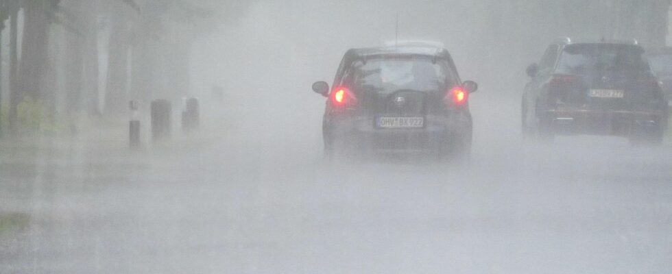
The German Weather Service is expecting severe storms on Tuesday, particularly in western and central Germany. The risk of severe weather will remain high in some areas over the coming days. Maps show where it will be particularly stormy.
The warm temperatures are still a long way off. Instead, it is wet and stormy. On Tuesday, heavy rain is expected, particularly in western and central Germany. Severe weather expected. According to the German Weather Service (DWD), individual strong thunderstorms are expected to develop from late morning onwards. In the evening, severe weather is also expected in the east.
Large hailstones, strong storm or hurricane gusts and heavy rain with precipitation amounts of up to 30 litres per square metre are to be expected in some areas. According to meteorologists, isolated tornadoes cannot be completely ruled out in the west and in the centre. This is one reason why the Düsseldorf fan zones will also remain closed on Tuesday.

Although the north is not affected by the thunderstorms, heavy rain must be expected in the north and northwest of Germany. According to the DWD forecast from Tuesday morning, rainfall amounts of between 20 and 35 liters per square meter are possible within a few hours. The coast is excluded.
During the night into Wednesday, strong thunderstorms with stormy gusts, hail and heavy rain will again move from France to the southwest.
The maps below show the current weather conditions:
Weather map I: See live where storms are approaching
The interactive map below shows the weather in real time. You can also use the timeline at the bottom of the graphic to view the forecast for a later date. The level shown can be changed at the top right, for example to thunderstorms, rain or snow.
The service is provided by Windy.com. The creators use the model from the “European Centre for Medium-Range Weather Forecasts” for their representations and forecasts.
Weather map II for wind and storm: The fastest gusts of the day
The map above shows where the fastest wind gusts of the day are expected. It is provided – as are weather maps III and IV – by wetter.de, which, like stern, is part of RTL Germany.
Weather map III: Real-time precipitation and 48-hour forecast
The map above shows the precipitation in real time. It is provided by the portal Wetter.de, which, like Stern, belongs to RTL Germany. Clicking on the map takes you to Wetter.de
Weather map IV: Thunderstorm warnings for today
The map above shows the DWD’s thunderstorm warnings for today. It is a binary weather map, meaning that places for which there is a thunderstorm warning are colored red. No coloring means no warning.
Tips on what to do during a thunderstorm
Sources: DWD with dpa