Status: 02/20/2022 12:39 p.m
The storm “Zeynep” left several deaths and immense damage in Germany. And now the next storm “Antonia” with new hurricane gusts is approaching. Hold on until Monday, says the German Weather Service.
The full extent of the damage caused by “Ylenia” and “Zeynep” has not yet been recorded, but new adversity is already threatening: storm “Antonia” is approaching. Strong winds with sometimes hurricane-force gusts are expected. Especially in the coming night it can be dangerous again.
“We still have to get through the storm situation until Monday,” said a meteorologist from the German Weather Service (DWD) in Offenbach. “It gets interesting from 9 p.m. on Sunday evening,” said the weather expert. Then the wind will increase again significantly and move through the country from north-west to south-east in connection with a cold front. In the meantime, there is a risk of violent storms and hurricane-force gusts with wind speeds of up to 115 km/h. Heavy showers and thunderstorms are to be expected.
From Tuesday relaxation
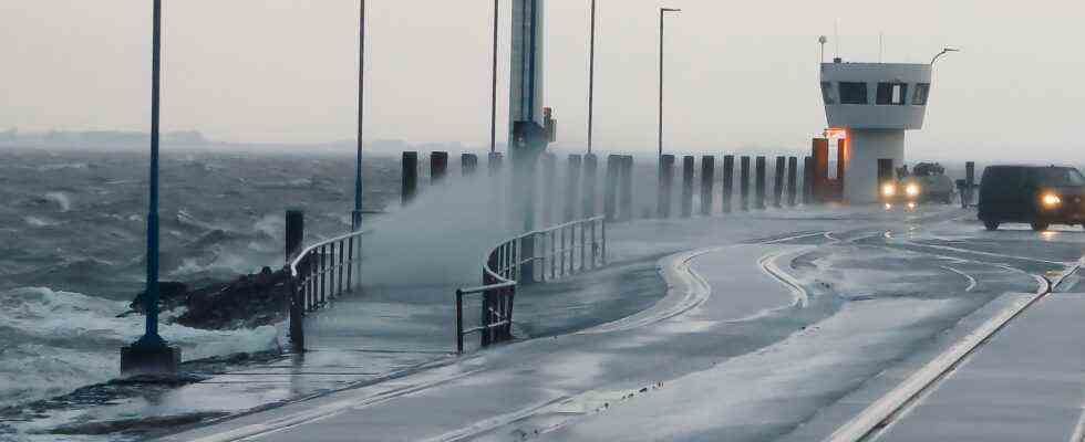
Hurricane-like gusts on the Baltic Sea can last until Monday morning. However, the danger of severe gusts of wind is not quite as high over the middle of Germany. In the morning the cold front reaches the foothills of the Alps. Especially in southern Bavaria, hurricane-like gusts cannot be ruled out. At noon the storm calmed down a bit. “But Monday will also be a windy, stormy day with lots of rain,” said the meteorologist.
Towards evening the wind will be noticeably slowed down and from Tuesday the situation will relax significantly. “The wind will remain an issue for the week,” said the meteorologist. “However, that will be a completely different house number than what we are experiencing these days.”
More train cancellations and delays
The storm days also have immense consequences for travel. Due to storm damage, rail travelers must continue to expect train cancellations and delays. There is currently damage on more than 1000 kilometers of track, the railway said in the morning.
In long-distance traffic, there were still significant problems, especially in northern Germany on Sunday. According to the railways, regional traffic could be resumed on most of the affected routes. There are also long-distance ICE trains between Berlin and Hanover to North Rhine-Westphalia. There are also individual trains on the Munich, Hanover, Bremen and Hamburg routes. According to Deutsche Bahn, the Berlin – Leipzig/Halle (Saale) route has been free again since Saturday evening.
There will be severe impairments until at least Monday afternoon. Around 2,000 emergency services are on duty around the clock to remove fallen trees and repair overhead lines. Deutsche Bahn advised passengers to avoid traveling to the affected regions, especially to Hamburg. Before starting the journey, she recommended calling the free hotline at 08000 99 66 33 to inform.
Big financial damage
At the start of the weekend, hurricane low “Zeynep” caused a very severe storm surge in the north, disruptions to rail traffic and accidents on the roads. At least three people died. The storm also caused deaths and damage in other European countries, some as early as Friday. In total, at least 16 people died in Europe. Hundreds of thousands of residents in England, Poland and the Czech Republic were temporarily without electricity.
According to an initial estimate, “Zeynep” caused insured damage of more than 900 million euros in Germany. The storm was the most intense since “Kyrill” in 2007, said management consultancy Meyerthole Siems Kohlruss (MSK), which specializes in actuarial mathematics.
Clean-up work after the storm: Balance sheet of “Zeynep”
Tobias Gellert, NDR, daily topics 11:25 p.m., February 20, 2022
Top value at 162 kilometers per hour
The storm had crossed Germany with wind speeds of locally more than 160 kilometers per hour. The highest value was measured on Saturday night at around 162 kilometers per hour at the North Sea lighthouse “Alte Weser”, as reported by the DWD.