Official Warnings
Thunderstorms, heavy rain, risk of tornadoes: This map shows where storms are currently brewing
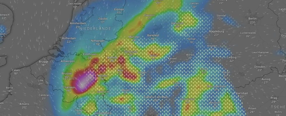
Thunderstorms and storms: The map shows the forecast for late Thursday afternoon. Current maps can be found at the bottom of the article
© Screenshot windy.com

In many parts of Germany, severe thunderstorms accompanied by sometimes heavy rainfall are to be expected. The map below shows where severe weather is brewing.
Table of contents
The provisional thunderstorm highlight of this week is on Thursday: According to the German Weather Service (DWD), a small low is moving eastwards across central Germany. In conjunction with muggy warm to hot subtropical air, this ensures a severe thunderstorm situation. The focus is therefore in the central and eastern parts of the country as well as in the south and south-west.
In North Rhine-Westphalia, rain falls around noon, which spreads north-east to Lower Saxony and the Hamburg area. In the course of this, some strong thunderstorms and heavy rain are to be expected into the night.

In the south and south-west of Germany, thunderstorms, heavy rain and hurricane gusts are also to be expected. According to the DWD, heavy thunderstorms will move from Bavaria to Brandenburg in the first half of the night on Friday, which will later disappear.
In a strip from the middle to the east there is also an increased risk of tornadoes, according to the DWD there is also a strong heat load in some areas, especially in the south and east (a detailed forecast can be found here).
Map: See live where thunderstorms are brewing
The interactive map below shows where it is currently lightning, thundering and raining. In addition, you can use the timeline at the bottom of the graphic to call up the forecast for a later point in time. At the top right, the displayed level can also be switched to rain or snow, for example.
The service is provided by Windy.com. The makers use the model from the “European Center for Medium-Range Weather Forecasts” for their representations and forecasts.
Sources: DWD
pictures of the day
sun salutation
In the gallery: The pictures of the day tell small and big stories from all over the world